


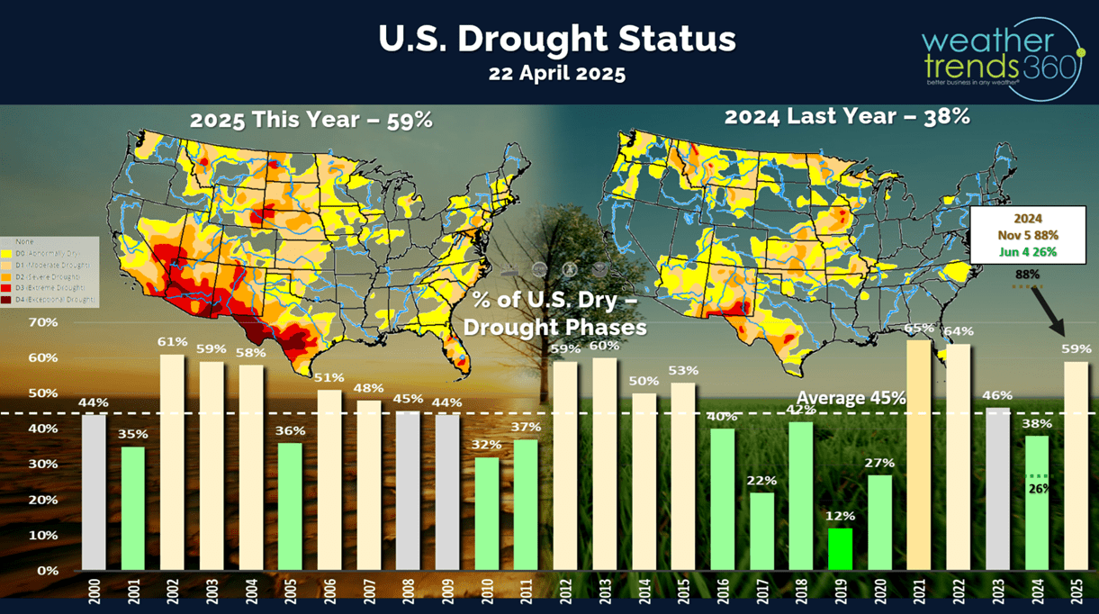
Drought conditions diminished a bit nationally with improved conditions in the U.S. Corn Belt, Midwest. Nationally, 59% of the U.S. is in dry to drought phases vs only 38% last year (wet). Average this time of year is 45%. CLICK ON IMAGES FOR A LARGER VIEW.
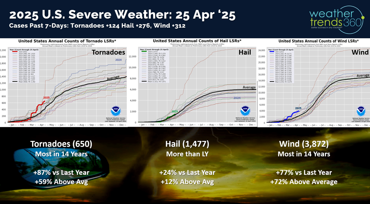
It was another active severe weather week adding 124 tornado events, 276 hail events and 312 high wind events. Tornadoes and wind cases are trending the most in 14 years, while hail is up over last year.
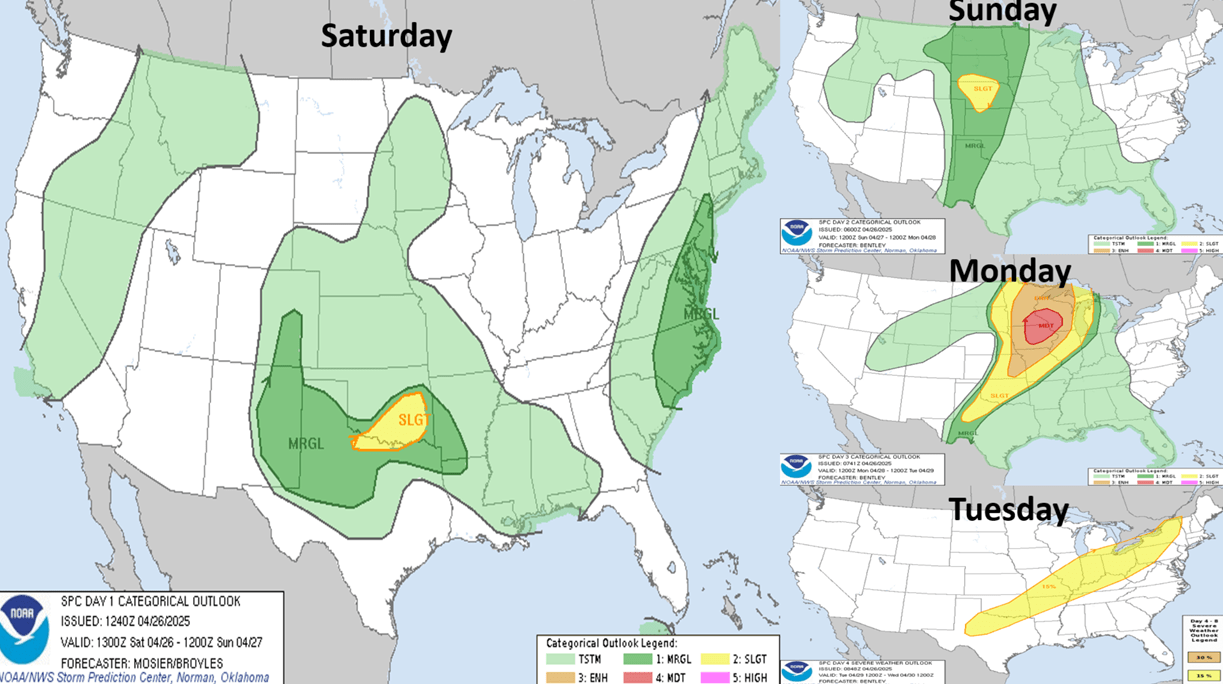
The next 4-days show the severe weather shifting farther north into the Upper Midwest with a higher risk event on Monday.
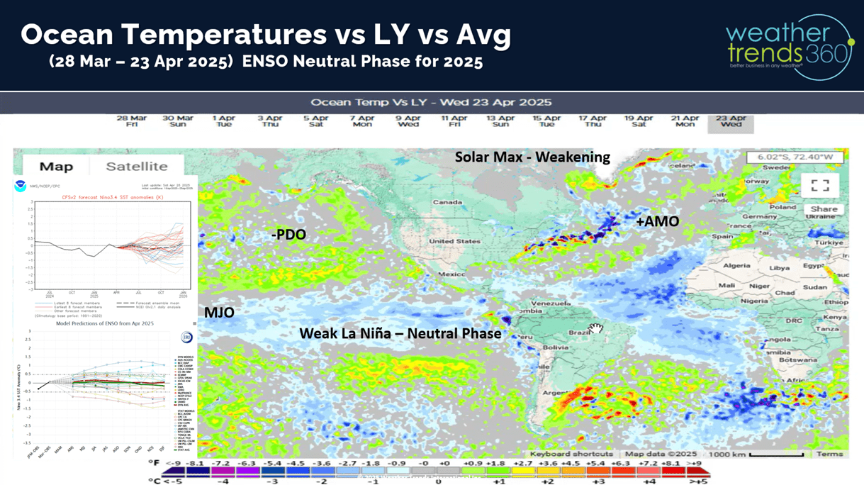
La Niña is officially over and now it appears an ENSO neutral phase will dominate the rest of 2025.
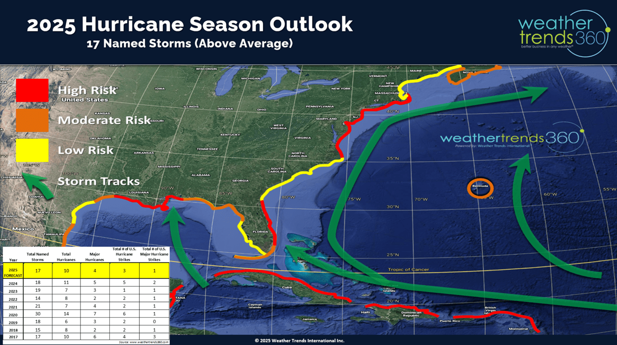
Weaker neutral ENSO events combined with a few other oceanic cycles shows higher risk for hurricane activity along the East Coast of Florida and the Northeast U.S. The North Central Gulf has higher risk as well.
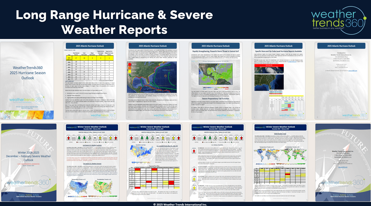
wt360 produces many hurricane and severe weather reports both year-ahead and shorter-term updates to help larger retailers and seasonal suppliers capitalize and plan for these extreme events.
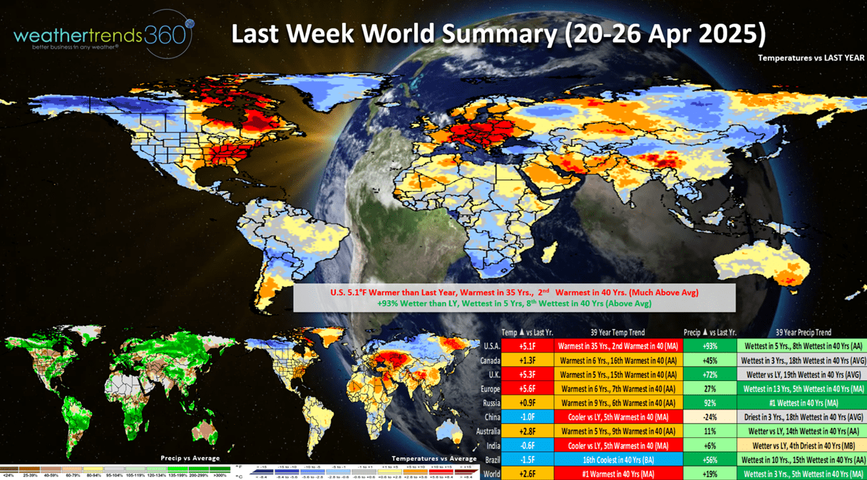
Last week (20-26 Apr) across the World shows the U.S. trending +5.1F warmer than last year, warmest in 35 years and 2nd warmest in 40 years. Rainfall was way up +93% over last year, wettest in 5 years and 8th wettest in 40 years. This was a mix bag of good-bad news for retail seasonal sales as warmer/drier weather is the most ideal condition for stronger sales. The U.K. and Europe were also much warmer and wetter so same general retail trends.
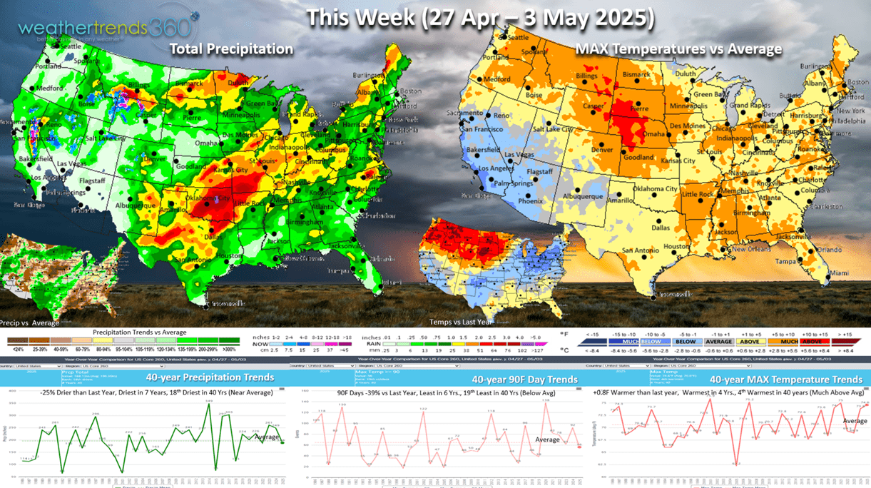
This week (27 Apr - 3 May) is the last week of the retail Q1 (Feb - Apr) ending on a positive note with both temperatures trending warmer than last year and drier than last year. This is a little misleading as the colder YOY conditions stretch from California to Texas and especially the Great Lakes Northeast, so more of the population is having less favorable trends. Hot 90F days are down -39%, least in 6 years and 19th least in 40 years (below average). So, an OK week to end the quarter.
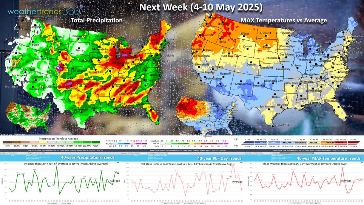
Next week (4-10 May) the U.S. trends +0.3F warmer than last year and 12th warmest of the past 40 years. The same general trends of less favorable (cooler) for the Eastern half of the country, much hotter than last year in the Northwest. Rainfall down -3% but still 5th wettest of the past 40 years with widespread heavier rainfall. Hot 90F days are again way down -62%, least in 6 years and 13th least of the past 40 years. This is a negative for hot seasonal categories that did well the previous 5 years.
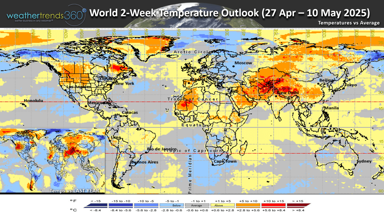
The World 2-week Temperature outlook (27 Apr - 10 May) shows the Northwest the most favorable and the Great Lakes the least favorable for hot seasonal merchandise sales. Western Europe is better than Eastern Europe.
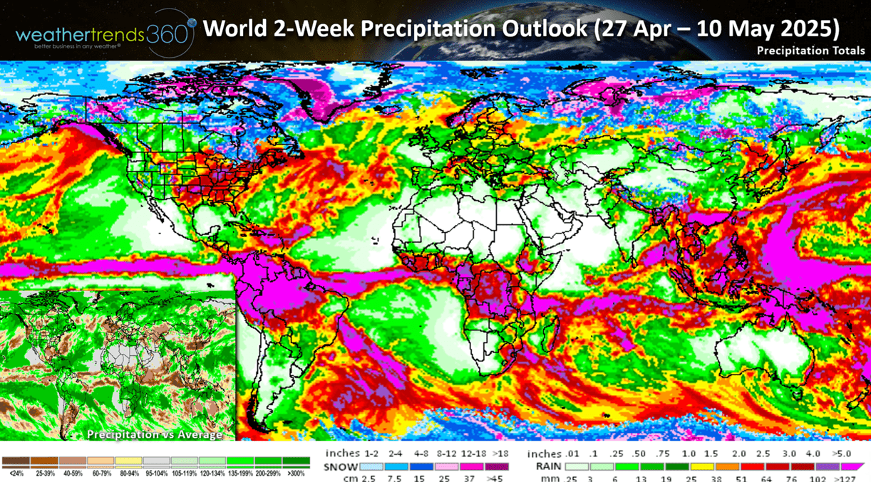
The World 2-week Precipitation outlook (27 Apr - 10 May) shows the U.S. relatively wet, but down from last year's #1 wettest period in 40 years. Some of Brazil's key growing regions (coffee, sugar, corn) continue to get much above average rainfall. The U.K. looks very dry benefiting outdoor category sales.
Have a great week, and don't forget to follow us on social media for frequent updates: Facebook, Twitter, YouTube, Pinterest and Linkedin.
- Captain Kirk out


