wt360 Weather Brief 26 Sep '26: Favorable Trends East for Fall Apparel (Wettest in 8 years)
Captain's Log
26 Sep '26: Happy Saturday. :)
The two big weather events this week is the first of many WET Nor'easters in the East and the remnants of Hurricane Polo moving into the Southwest then across the U.S. midweek. CLICK ON IMAGES FOR A LARGER VIEW.
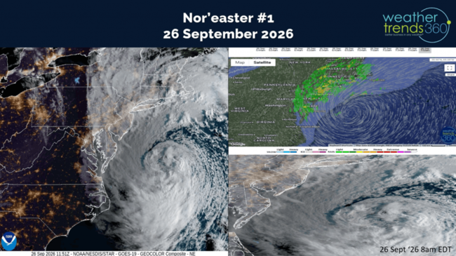
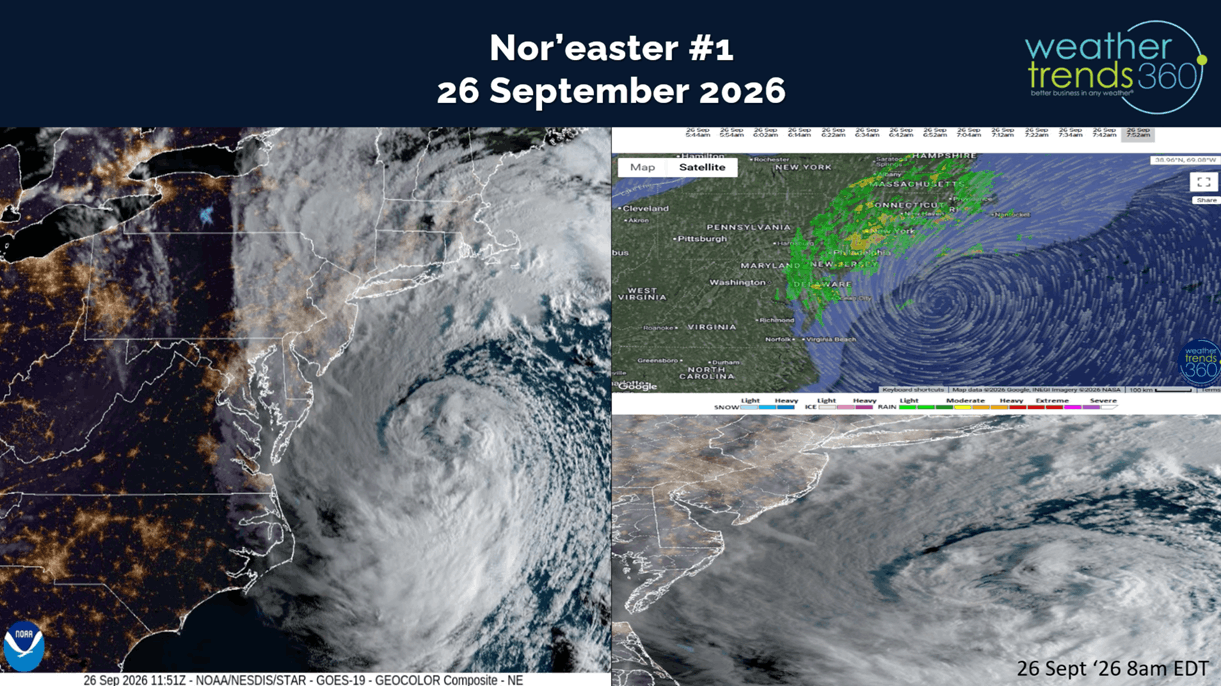
The Nor'easter is a combination of cold and warm airmass colliding over record warm Gulf Stream. While it has an eye like structure, this is not a hurricane which is a completely warm core system. But, it's still creating major beach erosion due to its very slow movement. Virginia to Long Island particularly hard hit with beach erosion and coastal tidal surge flooding with the Full Moon.
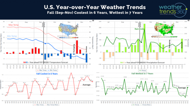
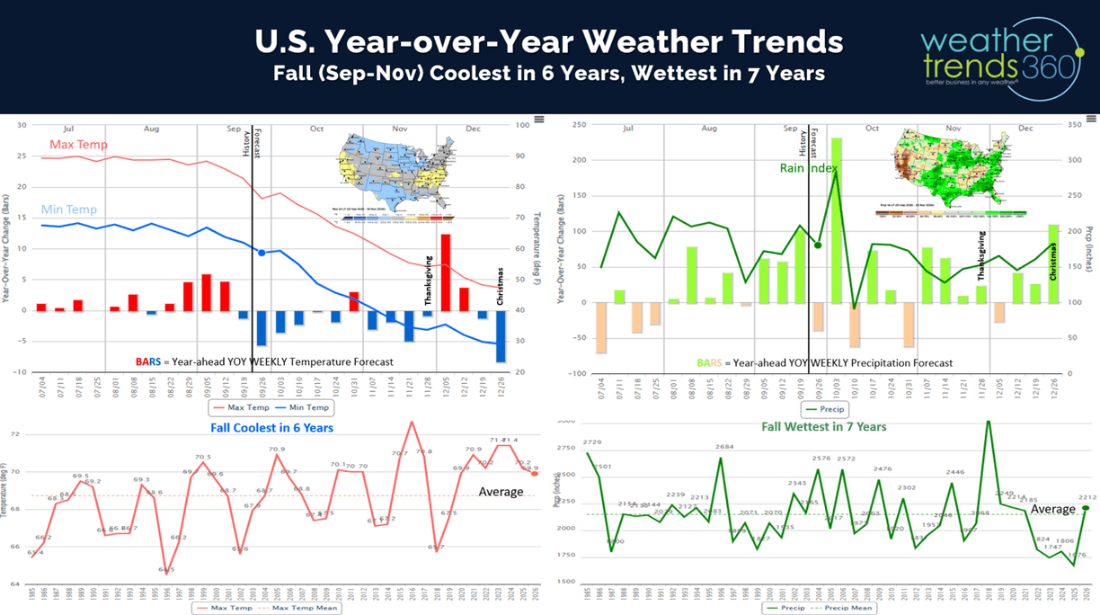
El Niño is clearly having an atmospheric response with the increasingly wet and stormy pattern in the U.S. The warmer/drier trends back in July have given way to a much wetter and cooler trend here in middle September into Fall. Still above average overall, but Fall appears to trend the coolest in 6 years and wettest in 7 years nationally which will help to boost Fall apparel merchandise.
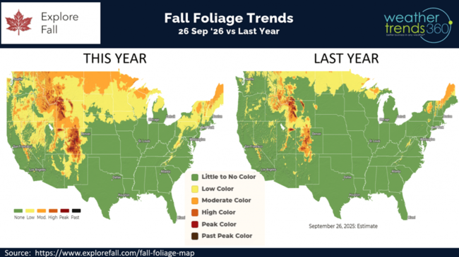
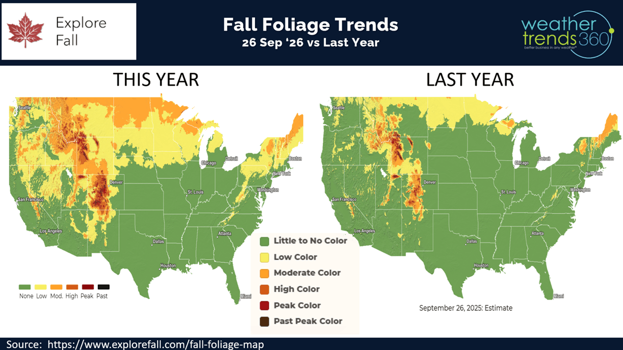
With the extreme dryness in the West, Fall Foliage color is off to a very fast start compared to last year. Already peaking in the Central Rocky Mountains.
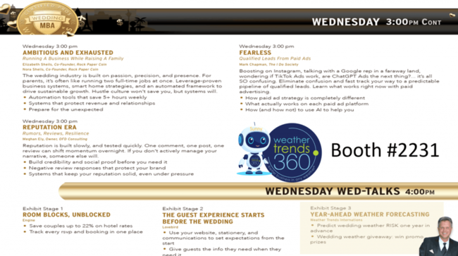
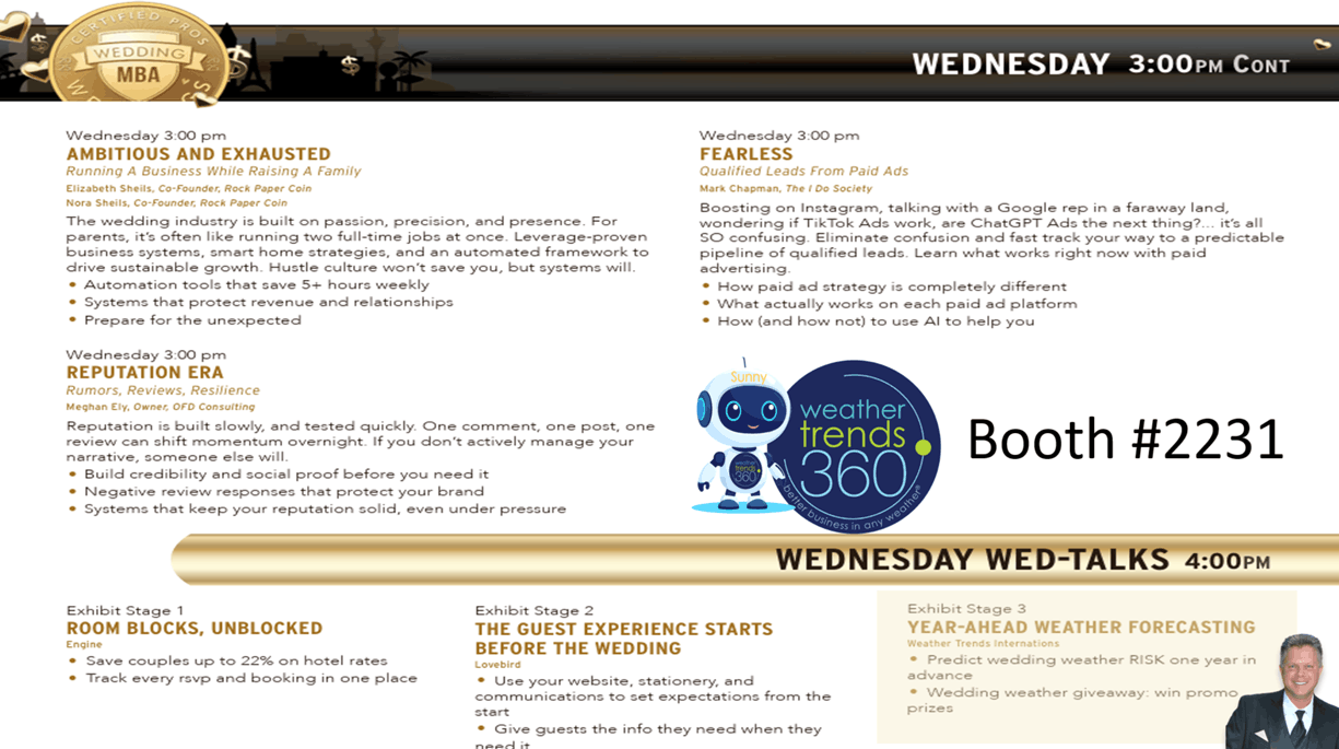
Sunny, the wt360 AI year-ahead weather companion will take the stage at the Wedding MBA Conference in Las Vegas 17-19 November. Stop by and see us at booth #2231 or our talk at 4pm on the 18th as we demonstrate how we can bring a little less weather risk to the bride and groom.
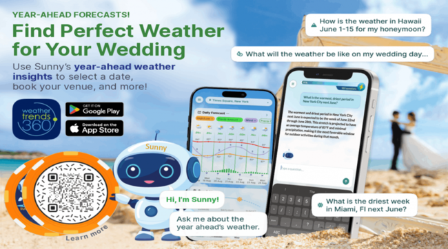
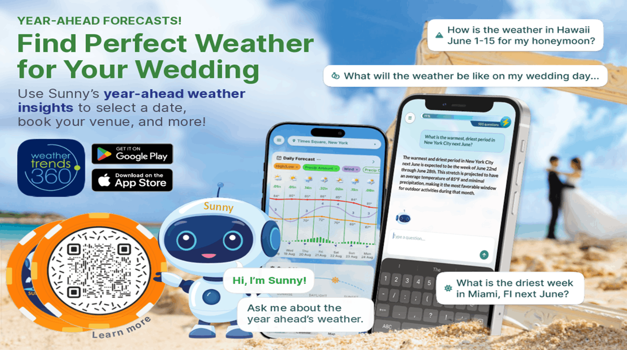
Predicting an hour event a year-ahead isn't easy, but if you know the week is expected to be the warmest/driest in 17 years vs the coldest/wettest in 10 years, the odds strongly favor the warmer/drier week for a more ideal wedding.

Apply the same logic when looking for a warmer/drier honeymoon weather anywhere in the World. Download the new weathertrends360 app with Sunny AI companion today:
Apple: https://apps.apple.com/us/app/weathertrends360-year-ahead/id6767758303
Android: https://play.google.com/store/apps/details?id=com.weathertrends.app
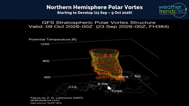
The developing Polar Vortex over the North Pole looks like it will reach the surface by middle October. A strong PV keeps cold air bottled up at the pole, weak allows Arctic air to dive into the Northern Hemisphere. We're leaning strong PV this year with two very strong Polar and Sub-Tropical Jet Streams bringing in milder Pacific Air to the U.S. this Winter.
Last week (20-26 Sep) across the World shows the U.S. trending -3.2F colder than last year with the greatest change toward colder weather for most of the World. The U.S. was the coolest in 6 years but 16th warmest in 41 years nationally. The Midwest to the Northeast was the cold spot with the highest demand for Fall apparel and seasonal merchandise. Hot 90F days the least in 5 years, while rainfall was -19% drier than LY, driest in 3 years and 20th driest in 41 years (near average)
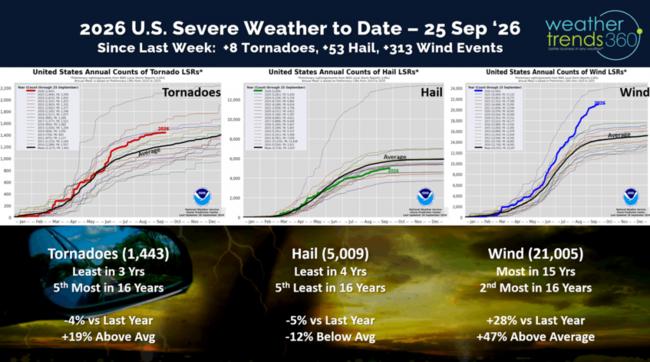
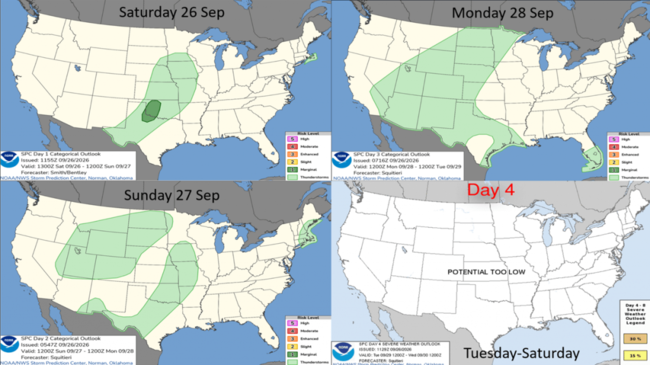
Not much in the way of severe weather last week, and the week ahead shows garden variety thunderstorms.
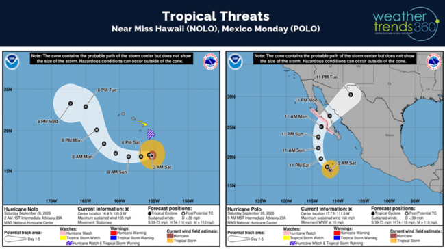
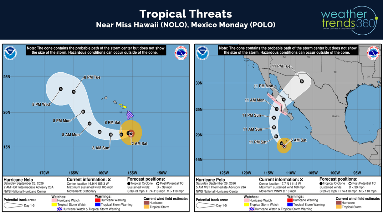
Definitely not garden-variety hurricanes in the Pacific with Major Hurricane POLO moving into Mexico Tuesday and Hawaii dodging a bullet with soon to be Major Hurricane NOLO passing well South of the Islands.
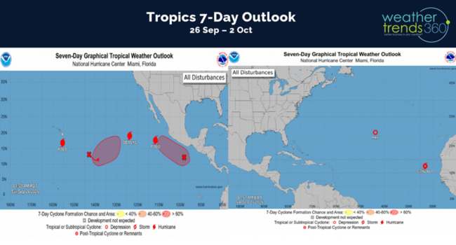
Fish storms in the Atlantic getting sheared apart for one of the least active Atlantic hurricane season in over 150 years...classic El Niño.
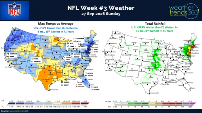
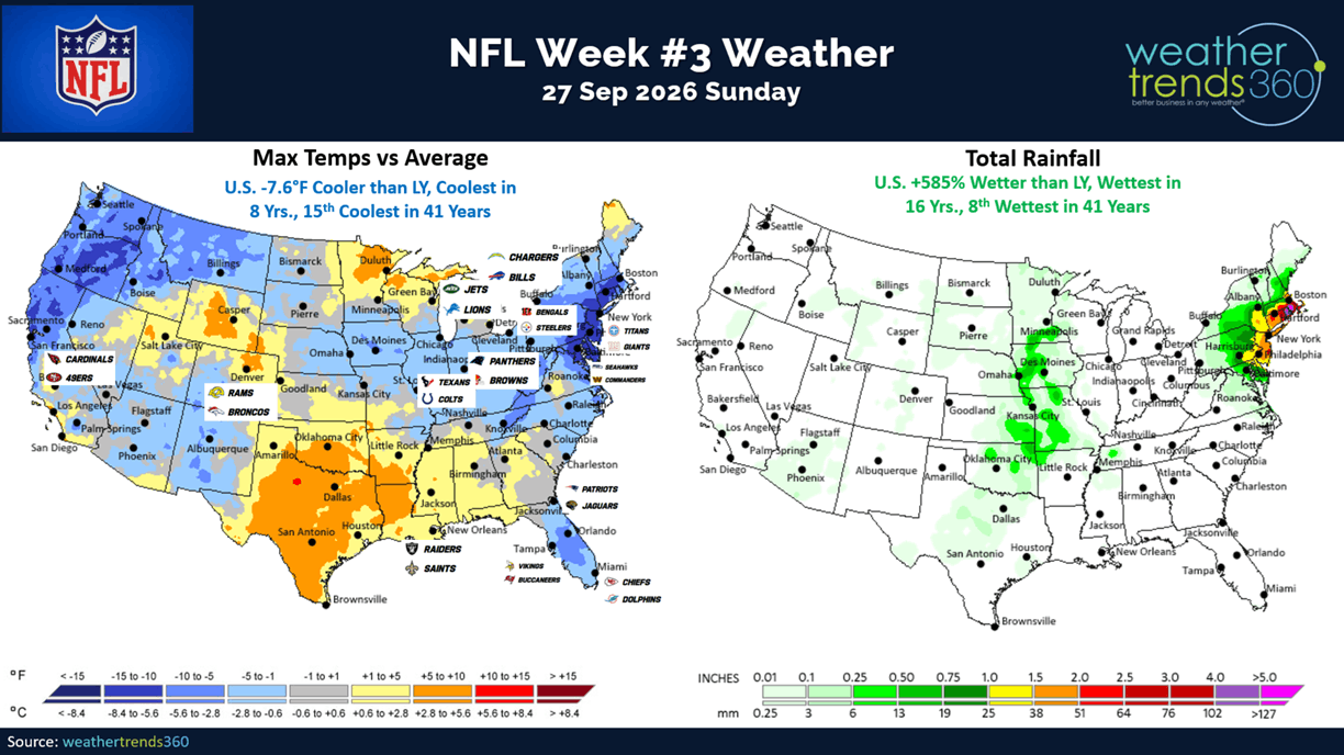
Week 3 for the NFL and it's definitely more Fall-like than this weekend last year trending the coolest in 8 years, 15th coolest in 41 years, wettest in 16 years (due to the Nor'easter) and 8th wettest in 41 years. This will boost gameday hot beverage and apparel merchandise sales.
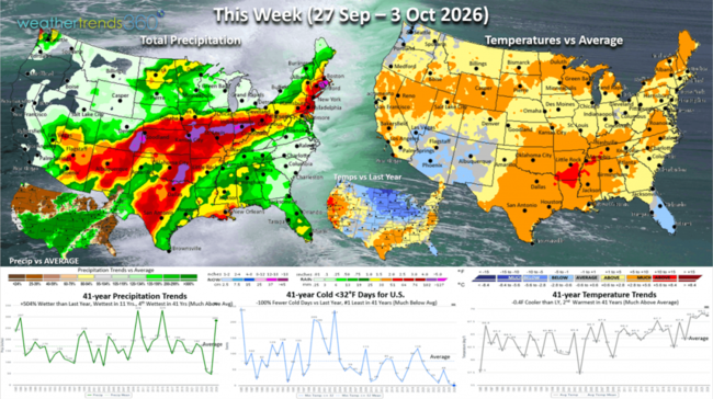
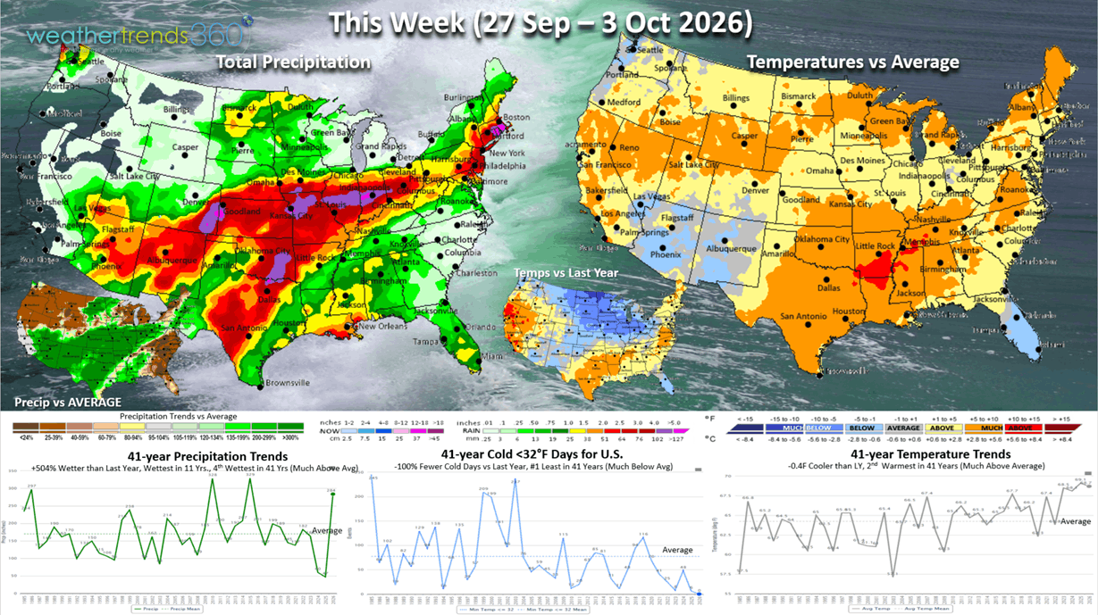
This week (27 Sep - 3 Oct) shows a warming trend in the East with the U.S. overall trending -0.4F cooler than LY but 2nd warmest in 41 years. Rainfall up +504% vs LY, wettest in 11 years and 4th wettest in 41 years will help with some Fall merchandise sales, but outdoor Halloween decor, garden, pool supplies harder hit. Very clear signs show the tropical remnants of Hurricane Polo sweeping from Texas to the Midwest even into the Northeast.
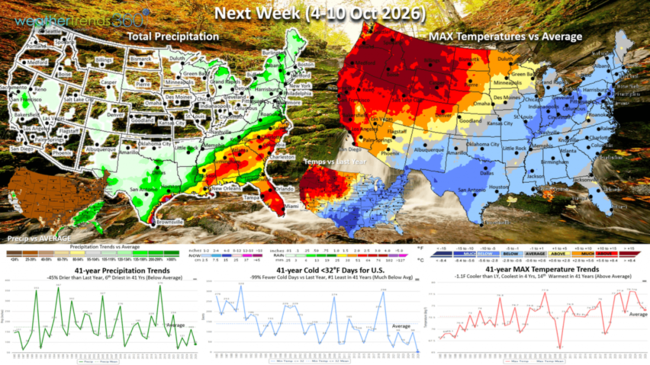
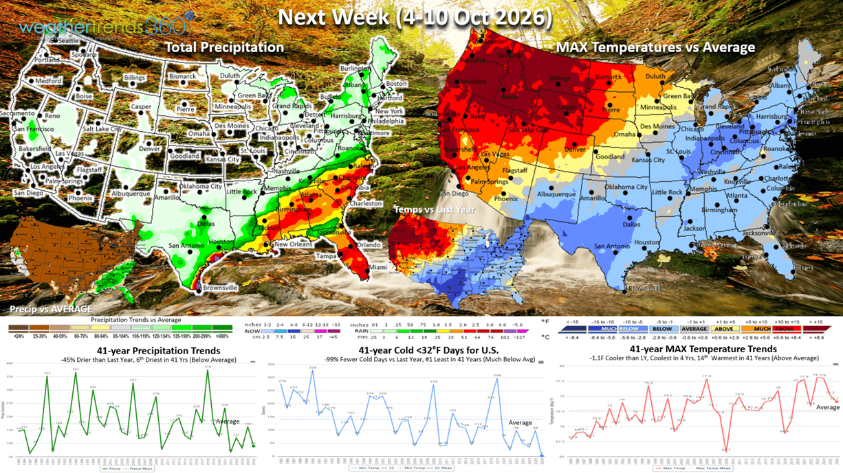
Next week (4-10 Oct) shows a tale of two halves with cold conditions in the East from TX to NY and HOT in the Northwest. The U.S. overall trends -1.1F cooler than LY, coolest in 4 years but 14th warmest in 41 years. National rainfall down -45% vs LY and 6th driest in 41 years.
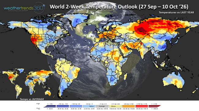
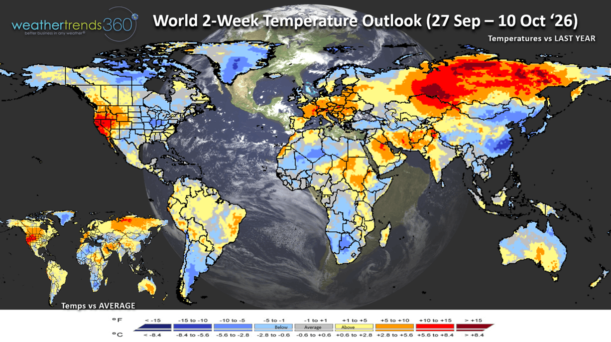
The World 2-week Temperature outlook (27 Sep - 10 Oct) shows the TX to PA areas the most favorable for cold category Fall merchandise sales, while the West bakes - very unfavorable. Very unfavorable in Europe as well, while China is very cool.
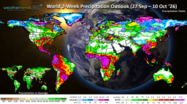
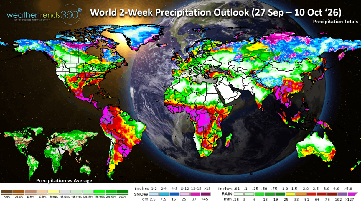
The World 2-week Precipitation outlook (27 Sep - 10 Sep) shows heavy rain in the parched Plains but very dry in the West and Northwest U.S. and much of Europe. This time of year cooler/wetter weather drives higher Fall apparel and cool weather merchandise.
You can get this blog in your email inbox every weekend (FREE) via subscription.
Have a great week ahead, and don't forget to follow us on social media for updates: Facebook, Twitter(X), YouTube, Pinterest and Linkedin.
- Captain Kirk out (USAF Gulf War Veteran 1989-1999)
The two big weather events this week is the first of many WET Nor'easters in the East and the remnants of Hurricane Polo moving into the Southwest then across the U.S. midweek. CLICK ON IMAGES FOR A LARGER VIEW.
The Nor'easter is a combination of cold and warm airmass colliding over record warm Gulf Stream. While it has an eye like structure, this is not a hurricane which is a completely warm core system. But, it's still creating major beach erosion due to its very slow movement. Virginia to Long Island particularly hard hit with beach erosion and coastal tidal surge flooding with the Full Moon.
El Niño is clearly having an atmospheric response with the increasingly wet and stormy pattern in the U.S. The warmer/drier trends back in July have given way to a much wetter and cooler trend here in middle September into Fall. Still above average overall, but Fall appears to trend the coolest in 6 years and wettest in 7 years nationally which will help to boost Fall apparel merchandise.
With the extreme dryness in the West, Fall Foliage color is off to a very fast start compared to last year. Already peaking in the Central Rocky Mountains.
Sunny, the wt360 AI year-ahead weather companion will take the stage at the Wedding MBA Conference in Las Vegas 17-19 November. Stop by and see us at booth #2231 or our talk at 4pm on the 18th as we demonstrate how we can bring a little less weather risk to the bride and groom.
Predicting an hour event a year-ahead isn't easy, but if you know the week is expected to be the warmest/driest in 17 years vs the coldest/wettest in 10 years, the odds strongly favor the warmer/drier week for a more ideal wedding.

Apply the same logic when looking for a warmer/drier honeymoon weather anywhere in the World. Download the new weathertrends360 app with Sunny AI companion today:
Apple: https://apps.apple.com/us/app/weathertrends360-year-ahead/id6767758303
Android: https://play.google.com/store/apps/details?id=com.weathertrends.app
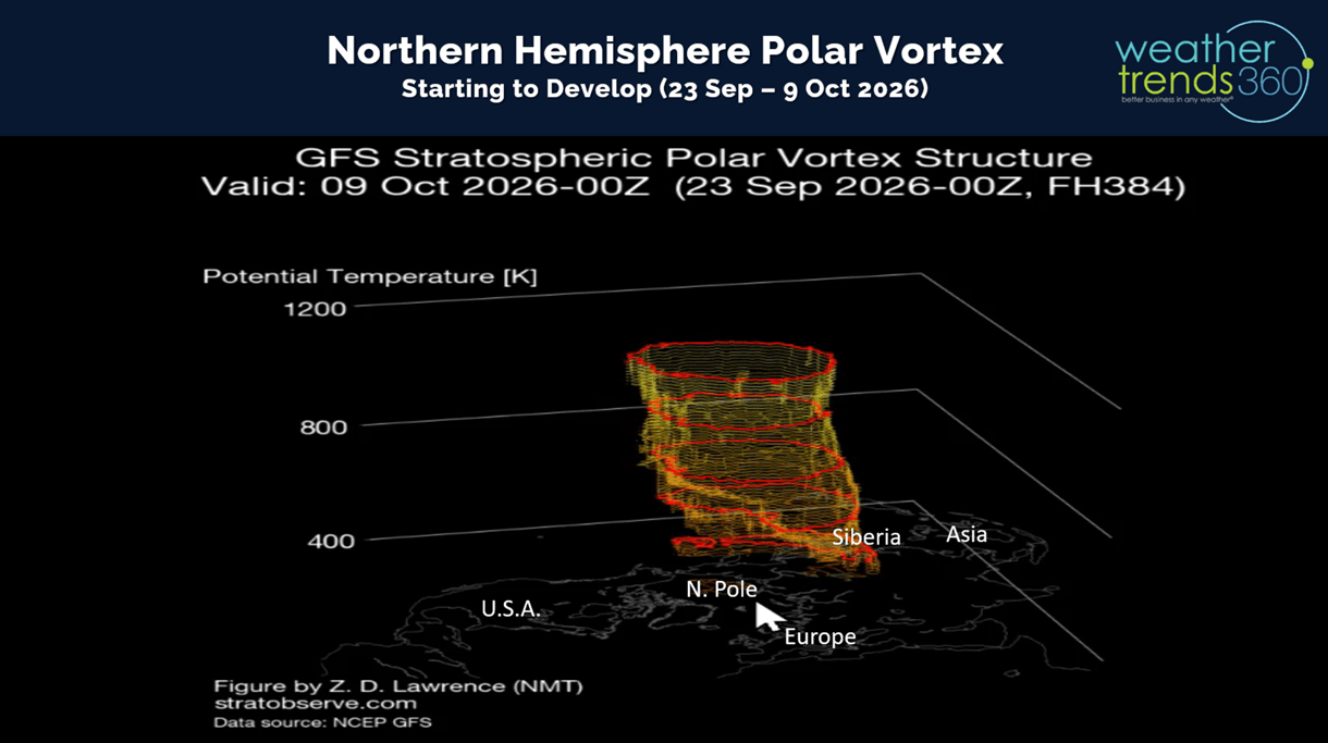
The developing Polar Vortex over the North Pole looks like it will reach the surface by middle October. A strong PV keeps cold air bottled up at the pole, weak allows Arctic air to dive into the Northern Hemisphere. We're leaning strong PV this year with two very strong Polar and Sub-Tropical Jet Streams bringing in milder Pacific Air to the U.S. this Winter.
Last week (20-26 Sep) across the World shows the U.S. trending -3.2F colder than last year with the greatest change toward colder weather for most of the World. The U.S. was the coolest in 6 years but 16th warmest in 41 years nationally. The Midwest to the Northeast was the cold spot with the highest demand for Fall apparel and seasonal merchandise. Hot 90F days the least in 5 years, while rainfall was -19% drier than LY, driest in 3 years and 20th driest in 41 years (near average)
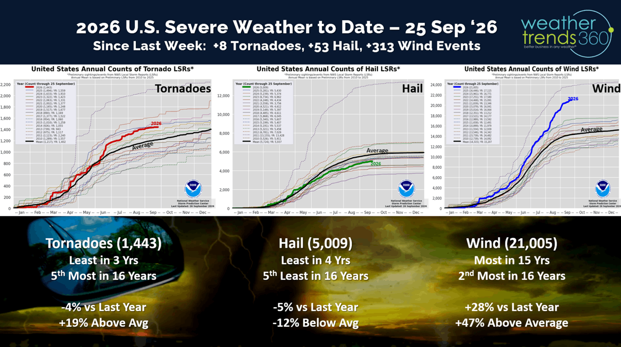
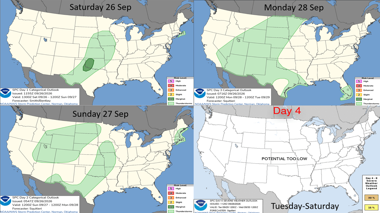
Not much in the way of severe weather last week, and the week ahead shows garden variety thunderstorms.
Definitely not garden-variety hurricanes in the Pacific with Major Hurricane POLO moving into Mexico Tuesday and Hawaii dodging a bullet with soon to be Major Hurricane NOLO passing well South of the Islands.
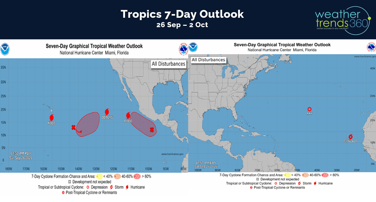
Fish storms in the Atlantic getting sheared apart for one of the least active Atlantic hurricane season in over 150 years...classic El Niño.
Week 3 for the NFL and it's definitely more Fall-like than this weekend last year trending the coolest in 8 years, 15th coolest in 41 years, wettest in 16 years (due to the Nor'easter) and 8th wettest in 41 years. This will boost gameday hot beverage and apparel merchandise sales.
This week (27 Sep - 3 Oct) shows a warming trend in the East with the U.S. overall trending -0.4F cooler than LY but 2nd warmest in 41 years. Rainfall up +504% vs LY, wettest in 11 years and 4th wettest in 41 years will help with some Fall merchandise sales, but outdoor Halloween decor, garden, pool supplies harder hit. Very clear signs show the tropical remnants of Hurricane Polo sweeping from Texas to the Midwest even into the Northeast.
Next week (4-10 Oct) shows a tale of two halves with cold conditions in the East from TX to NY and HOT in the Northwest. The U.S. overall trends -1.1F cooler than LY, coolest in 4 years but 14th warmest in 41 years. National rainfall down -45% vs LY and 6th driest in 41 years.
The World 2-week Temperature outlook (27 Sep - 10 Oct) shows the TX to PA areas the most favorable for cold category Fall merchandise sales, while the West bakes - very unfavorable. Very unfavorable in Europe as well, while China is very cool.
The World 2-week Precipitation outlook (27 Sep - 10 Sep) shows heavy rain in the parched Plains but very dry in the West and Northwest U.S. and much of Europe. This time of year cooler/wetter weather drives higher Fall apparel and cool weather merchandise.
You can get this blog in your email inbox every weekend (FREE) via subscription.
Have a great week ahead, and don't forget to follow us on social media for updates: Facebook, Twitter(X), YouTube, Pinterest and Linkedin.
- Captain Kirk out (USAF Gulf War Veteran 1989-1999)