Wet Weather Returns in Late June 2018
Breaking Weather Events
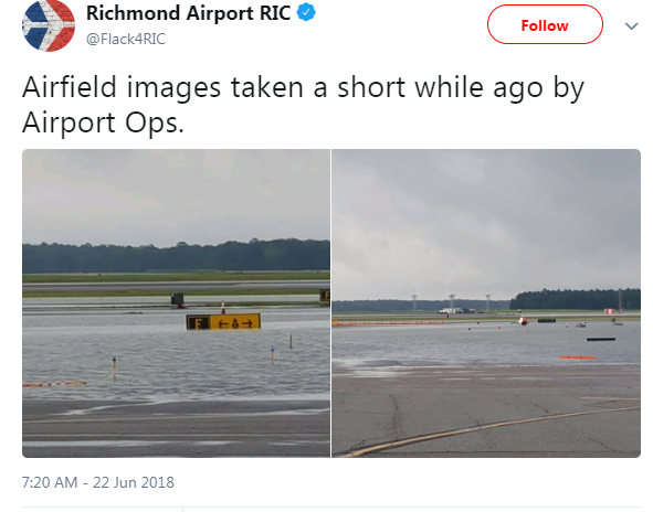
At least we can say we were able to squeeze in one nice weekend for Father's Day here in the Mid-Atlantic. This weekend we're back to the pattern of unsettled weekends. Rain and thunderstorms, some of them heavy, will have the potential to cause flash flooding, especially in areas that have recently seen heavy rain. Speaking of flooding, check out the pictures of the flooding at Richmond Airport this morning where over 5'' of rain fell early this morning.
It won't just be the Mid-Atlantic that will have to deal with wet weather this weekend, in fact, a large area from the Northern Rockies to the East Coast will see some threat of showers and/or thunderstorms this weekend. So bring the umbrella and ponchos if you have plans outdoors!
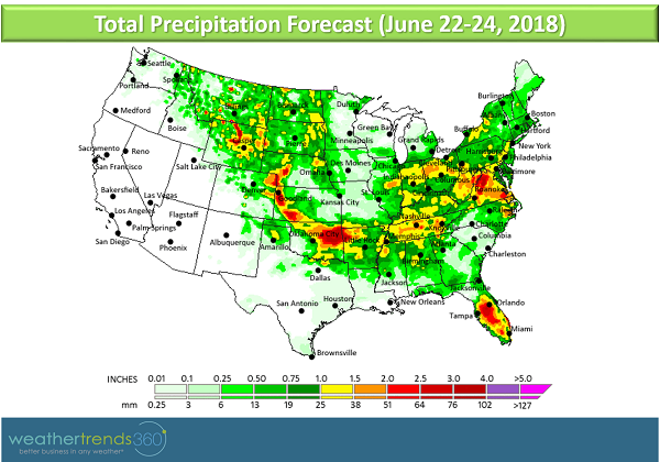
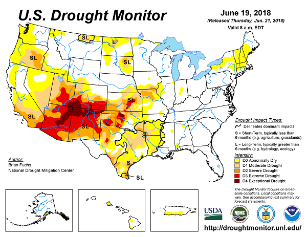
Luckily, the rain has mostly ended for the Texas Gulf Coast where tropical moisture this week has dumped over a foot of rain in some places. While the rain is very much needed in Texas, receiving it all at once is never ideal and caused flooding. The Texas Panhandle, meanwhile, continues with some large rainfall deficits and drought conditions. This weekend should be largely dry across the great state of Texas and to the West Coast where rain would be welcome as drought and conditions favorable for wildfires persist.
Temperatures will be on the cooler side relative to normal across the Midwest and parts of the Northeast under clouds and showers this weekend, but don't get used to it as we're tracking what could be a hot first week of July from the Plains to the Northeast. Stay tuned!

It won't just be the Mid-Atlantic that will have to deal with wet weather this weekend, in fact, a large area from the Northern Rockies to the East Coast will see some threat of showers and/or thunderstorms this weekend. So bring the umbrella and ponchos if you have plans outdoors!

Luckily, the rain has mostly ended for the Texas Gulf Coast where tropical moisture this week has dumped over a foot of rain in some places. While the rain is very much needed in Texas, receiving it all at once is never ideal and caused flooding. The Texas Panhandle, meanwhile, continues with some large rainfall deficits and drought conditions. This weekend should be largely dry across the great state of Texas and to the West Coast where rain would be welcome as drought and conditions favorable for wildfires persist.

Temperatures will be on the cooler side relative to normal across the Midwest and parts of the Northeast under clouds and showers this weekend, but don't get used to it as we're tracking what could be a hot first week of July from the Plains to the Northeast. Stay tuned!