Weather Forecasts & Recap for April 2021
Captain's Log
Happy Monday. :)
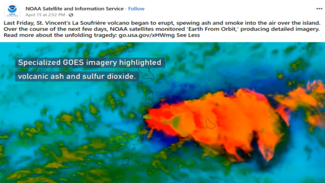
The La Soufriere volcanic eruption on St. Vincent is impressive, but so far the SO2 has been limited to the troposphere. When the SO2 gets up into the Stratosphere upper atmosphere, like Mount Pinatubo in 1991 and Mt. Tambura in 1815, then you need to worry about a global cooling event that can last several years. Something to watch for now. CLICK ON IMAGES FOR A LARGER VIEW.
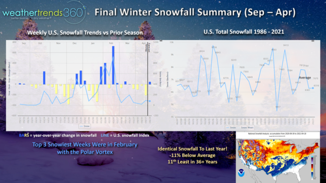
A winter recap of snowfall shows the U.S. ended up 11% below average, almost identical to last year and 11th least in 36 years. The three snowiest weeks were clearly in February as the Polar Vortex parked over North America for a few weeks.
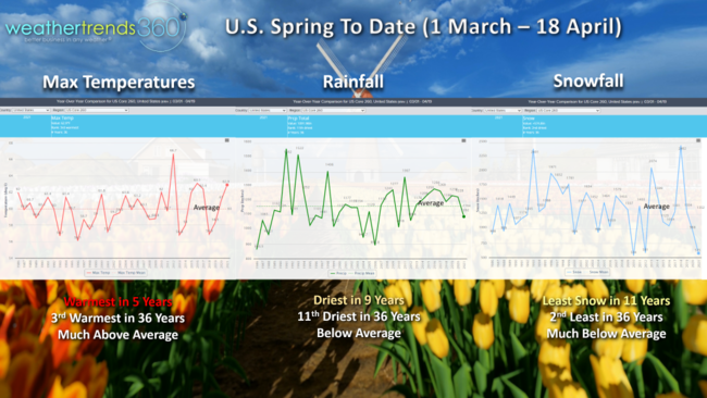
Spring to date (1 March - 18 April) shows the U.S. having the warmest Spring in 5 years, 3rd warmest in 36+ years (much above average), driest in 9 years and 11th driest in 36 years (below average) and snowfall the least in 11 years, 2nd least in 36 years (much below average).
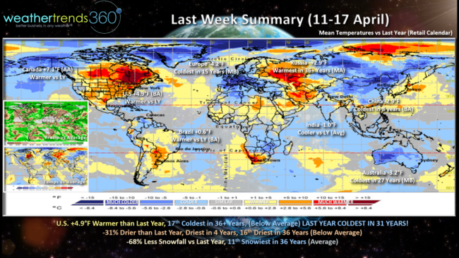
The World recap (11-17 April) for last week shows the U.S. trending +4.9F warmer than last year but still 17th coldest of the past 36 years. Still a big change from last year when the U.S. was the coldest middle April period in 31 years. Rainfall was 31% less than last year and least in 4 years with below average rainfall. Snowfall was 68% less than last year but still a bit above average for the U.S. overall.
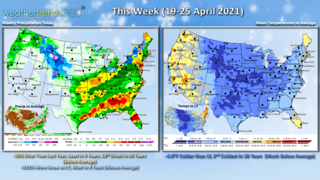
This week (19-25 April) shows a significant cool down with the U.S. trending 4F colder than last year and 2nd coldest in 36 years with much below average temperatures. Frost and freezes likely in the Central U.S. Rainfall is down 32% vs a year ago and least in 5 years (below average). Winter's last gasp likely to bring a swath of accumulating snow from the Northern Rockies into the Midwest, Ohio Valley and interior Northeast this week with snowfall trending +222% more than last year and most in 8 years. The colder and drier trend continues to keep tornadic activity below average for the season to date.
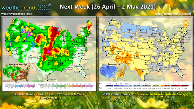
Next week (26 April - 2 May) shows a moderating trend with the U.S. still a tad cooler than last year but 11th warmest of the past 36 years with above average national temperatures. Rainfall remains on the dry side and least in 3 years for the U.S. overall.
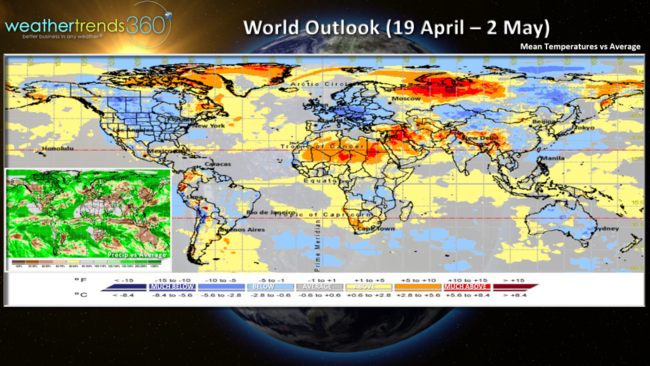
The World Outlook (19 April - 2 May) shows the cooler trends in North America, Europe and Australia with warmer conditions from Africa to South Central China.
Have a great week and don't forget to follow us on social media for updates: Facebook, Twitter, YouTube, Pinterest and Linkedin
- Captain Kirk out.