Polar Vortex Brings Snow in February 2021
Captain's Log
Happy Monday! :)
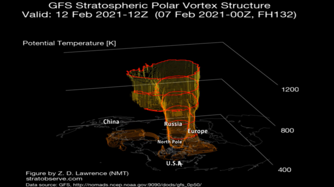
As the 2021 Polar Vortex invades the U.S. for the first time this Winter, snowfall will remain high on the periphery of the vortex. CLICK ON IMAGES FOR A LARGER VIEW.
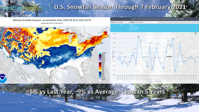
Despite the 2nd biggest snow storm in PA-NJ's history last week, U.S. season-to-date snowfall remains 5% less than last year and 9% below average for the least in 5 years. With 2 snowy weeks ahead, we'll add to this but still not likely to eclipse and average season, but should end up the most in 5 years when February is history. These are great weeks for seasonal snowfall categories with a great clearance opportunity here in middle February.
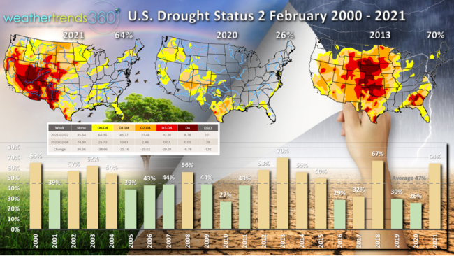
While the pattern has turned snowier with the Vortex invasion, dry to drought phases across the U.S. remain well above average at 64% compared to only 26% this time last year, average is 47% of the country in dry phases in early February. WTI expects this to remain high through the 2021 growing season.
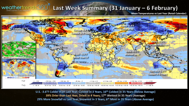
Last week (31 Jan - 6 Feb) across the World shows the U.S. trending 3.6F colder than last year, coldest in 3 years and 16th coldest of the past 36 years. Rainfall was 39% less than a year ago, driest in 4 years but still near average national rainfall. Snowfall was up 29% over last year, snowiest in 3 years and the 6th most of the past 36 years. Other really cold spots were in Europe - coldest in 9 years.
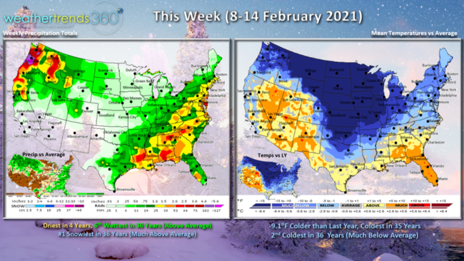
This week (8-14 February) shows the onslaught of the Polar Vortex in the heartland with sub-zero temperatures. On the periphery of the vortex there will be moderate snow sweeping across the U.S. from the Northern Rockies into the Midwest and Coastal Northeast. The U.S. overall trends 9.1F colder than last year making it the coldest 2nd week of February in 35 years. While drier than the previous 4 years, it's still well above average with the snowiest conditions in 36 years. This is certainly the peak week for extremely cold categories like Auto batteries that fail in extreme cold.
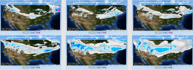
The 6-day snowfall outlook shows a parade of storms traversing the U.S. with widespread moderate totals.
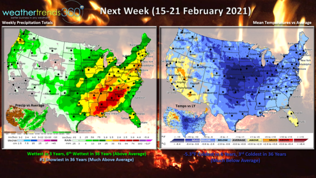
Next week (15-21 February) will start off frigid, but the vortex will begin to lift out with a moderating trend across the U.S. for the later part of the week.
Temperatures for the U.S. overall remain the coldest in 6 years and 3rd coldest of the past 36 years. Wettest in 3 years and still #1 snowiest in 36 years.
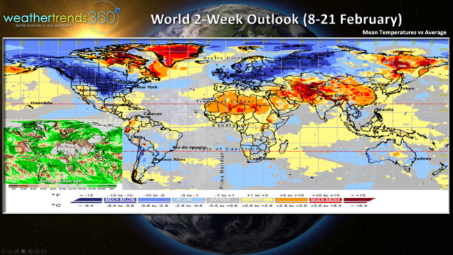
The 2-week World outlook shows the heart of the Vortex is invading the North America, Europe and Russia. Last in the period the cold will retreat back into Southwest Russia with a moderating trend in the U.S. and Southern Canada.
Have a great week and don't forget to follow us on social media for frequent updates: Facebook, Twitter, YouTube, Pinterest and Linkedin
- Captain Kirk out.