Mixed Weather in October of 2020
Captain's Log
Happy Monday! :)
Last week (11-17 October) across the World showed some bigger changes, but the U.S. overall still trending warmer than a year ago, +4.1F warmer, warmest in 3 years and 9th warmest of the past 35 years. CLICK ON IMAGES FOR A LARGER VIEW.
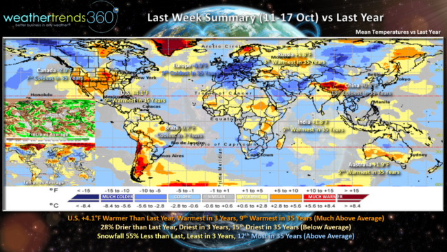
Rainfall was 28% drier than a year ago, least in 3 years and 15th driest of the past 35 years. Snowfall was also down 55% vs last year, least in 3 but 12th most in 35 years with slightly above average totals. Canada was colder and 7th coldest in 35 years, Europe was also colder trending 4.9F colder than last year and 9th coldest of the past 35 years. These cooler trends are very favorable for early Fall merchandise/on-line sales. Russia, India, Australia also trended warmer while Brazil finally cooled a bit trending coolest in 7 years.
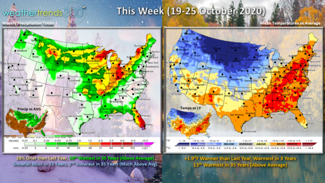
This week (19-25 Oct) across the U.S. again trends +1.9F warmer than last year, warmest in 3 years and 13th warmest of the past 35 years for the nation as a whole. But, it's a tale of two halves with very warm East and very cold Northwest. 28% drier than a year ago but still 10th wettest in 35 years. Snowfall most in 23 years with several light to moderate events across the Northern Rockies and Upper Plains.
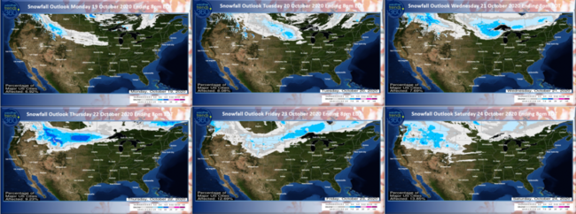
The 6-day snowfall outlook shows Montana and North Dakota as the biggest winners for moderate snowfall totals this week. The bigger system is midweek ahead of a stronger cold front.
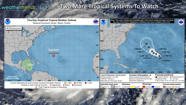
Off the East Coast we have another hurricane forming and heading toward Bermuda late this week. Models suggest a Cat 2 potential and hopefully it makes a right turn before threatening the U.S. or Southeast Canada. Still need to watch for a potential system South of Cuba as models have been hinting at a hurricane threat for Florida in late October - early November, so we're not out of the woods yet here in the U.S.
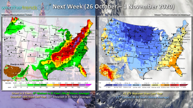
Next week (26 Oct - 1 Nov) a strong cold front pushes more that cold air from Canada down into the U.S. but remains warmer than average along the East Coast. Overall, still 2.3F warmer than last year but 11th coldest of the past 35 years. Driest in 3 years but still 6th wettest of the past 35 years as the cold and warm clash from Texas to Maine. Snowfall likely down 58% vs a year ago but need to watch for the first heavier snows in the high elevations of North Carolina to New York late in the period.
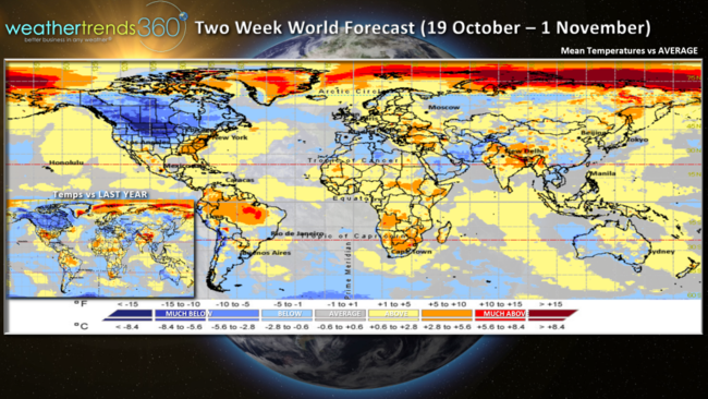
The two week aggregate World forecast (19 Oct - 1 Nov) shows Canada is coast-to-coast cold while the Eastern U.S. hangs onto milder trends.

A lot going on in late October into early November with a Halloween Full Moon, the end of Daylight Savings time 1 November and an election.

We'll end with some of the pretty Fall color here in Eastern PA. Survey's say a majority of us like this time of year, hope you're enjoying it...Winter will officially be here in 62 days, 16 hours and 54 minutes for those of you counting down.
Have a great week and don't forget to follow us on social media for frequent updates. Facebook, Twitter, YouTube, Pinterest and Linkedin
- Captain Kirk out.