Mild Weather Forecast for January 2021
Captain's Log
Happy Monday! :)
If you're thinking Spring, you only have 35 days to go according to meteorologists (1 March); if you want more Winter than go with the Sun that says we have 53 more days of Winter. CLICK ON IMAGES FOR A LARGER VIEW.
Last Week (17-23 January) around the world showed the U.S. trending 2F warmer than last year, warmest in 4 years, 11th warmest in 35 years. 64% Drier than last year, driest in 3 years and 5th driest in 35 years for the U.S. overall. Much needed rainfall and mountain snow for California.
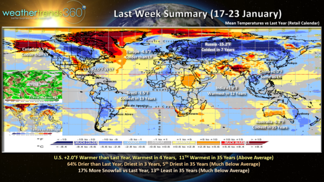
Russia showed the greatest change from last year, trending a whopping 15.2F colder than last year making it the coldest in 7 years. Australia came in second trending 6.2F cooler for their Summer making it the coolest middle January period in 35 years. Europe, Brazil and Canada all trended cooler than last year as well, while India again trended warmest in 12 years.
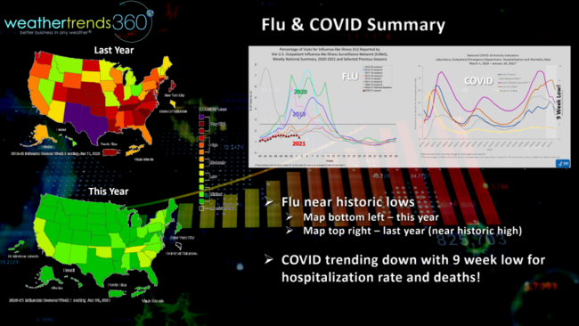
Flu remains near historic lows in the U.S., a wholesale change from the prior two seasons that had significant and widespread outbreaks across the U.S. COVID trends per the CDC show an improving trend on a national scale for hospitalization and death rates trending to 9 week lows.
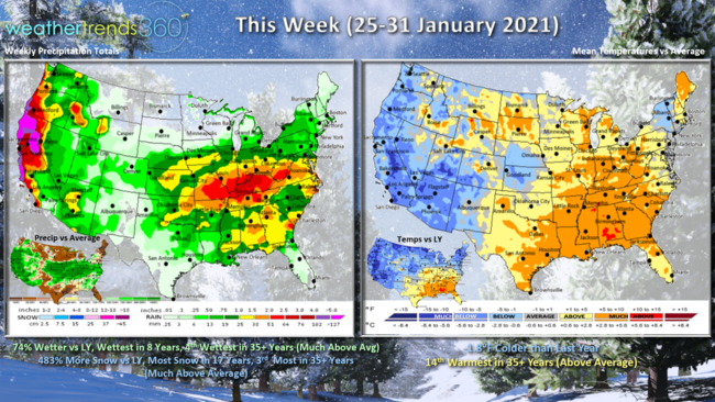
This week (25-31 January) across the U.S. shows the U.S. trending 1.8F colder than last year but still 14th warmest in 35 years for the nation overall. The Western U.S. shows the greatest trends to colder/wintry weather benefiting seasonal merchandise sales. A stormier pattern this week with rainfall 74% more than last year and most in 8 years, 4th most in 35 years while snowfall is up a whopping 483% over last year and most in 17 years.
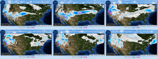
A couple wintry systems will traverse the U.S. this week going from coast to coast, but the big winners for snowfall will be the mountains of the Southwest including California and the Central U.S., especially Iowa. The storms appear to race off the East Coast out to sea rather than up the East Coast, so the snow appears to fizzle as it moves into the major cities of the East.
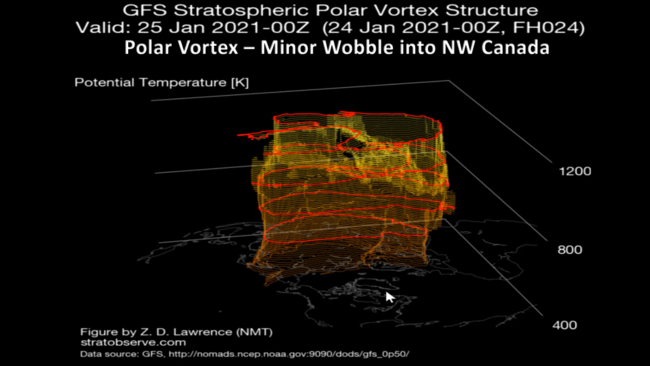
The Polar Vortex continues to wobble in a weaker state which can allow Arctic cold to invade areas in the Northern Hemisphere, but the 14-day outlook still doesn't show a major intrusion into the U.S. Parts of Northwest Canada and the NW US get glancing shots of colder weather. Late in the period it looks to become a bit more symmetrical which suggests the heart of the Arctic air will retreat back toward the North Pole.
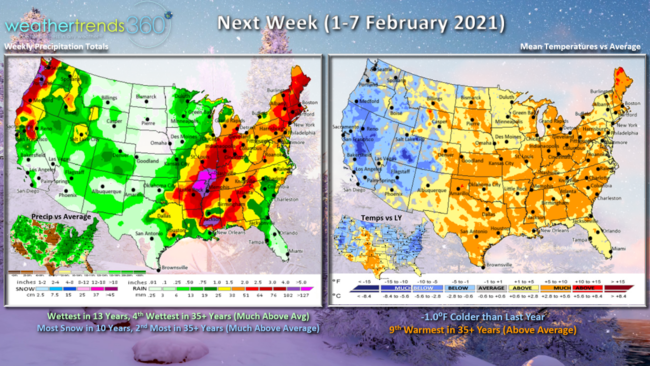
Next week (1-7 February) trends about 1F cooler than last year for the U.S. overall but still 9th warmest of the past 35 years. Still on the stormy side with the wettest conditions in 13 years and snowiest in 10 years so an OK period for Winter clearance sales, especially in the Western U.S.
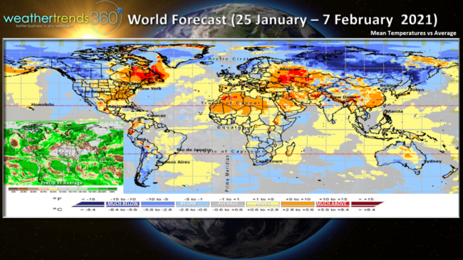
The 2-week World outlook (25 Jan - 7 Feb) shows areas that had been really cold (SW Russia, Europe) trending a bit warmer while conditions get colder across Alaska, Western Canada.
We hope you have a great week, and don't forget to follow us on social media for frequent updates: Facebook, Twitter, YouTube, Pinterest and Linkedin
- Captain Kirk out.