Hurricane Dorian Continues Track Towards Florida
Breaking Weather Events
We're continuing to monitor the progress of Hurricane Dorian, located this morning about 200 miles north-northwest of San Juan, Puerto Rico. Here are the important messages with this storm:
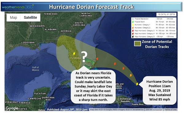
-Hurricane Dorian is forecast to have impacts on Florida's heavily-populated east coast late Sunday or early Labor Day
-Strengthening will occur prior to landfall or the closest approach to Florida, and Dorian will likely be a major hurricane (category 3 or higher)
-The exact track of the storm is still highly uncertain, landfall is likely in Florida but it's also still possible that the storm skirts the east coast of Florida
-Interests across the Southeast, including all the way to Cape Hatteras, need to continue to monitor Dorian or remnants thereof which could bring impacts to the region next week

Unfortunately, the latest model guidance is in disagreement about the track of Dorian as it nears Florida's east coast. One model has Dorian making landfall somewhere between Miami and Cape Canaveral, while another has the storm flirting with the east coast of Florida but potentially never making landfall.
Regardless of Dorian's ultimate track, he's already having an impact on retailers across the Florida Peninsula as stores quickly stock-out of storm supplies like bottled water, generators, batteries, and other goods. Expect this trend to continue over the next couple of days with store closures likely taking place beginning on Sunday.