Hot & Tropical Weather for August 2020
Captain's Log
Tuesday 25 August 3:30pm EDT Update on soon to be Major Hurricane Laura!
Happy Monday! :)
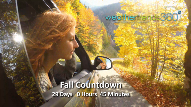
If you're tired of Summer, you have 29 days until Fall according to the Sun and only 7 days until Meteorological Fall starts (1 Sep - 30 Nov). CLICK ON IMAGES FOR A LARGER VIEW.
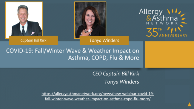
We spoke with the Allergy & Asthma Network recently discussing our Fall-Winter outlook and what we see for a bad Fall allergy and asthma season (worst in 4 years with a hot/dry Fall) but a not so bad Flu season which we believe will be a 5-week later start with a peak in late January and then a rapid end. Due in part to another warm and not so snowy Winter meaning more UV and hopefully less suffering after two very intense flu seasons. WEBINAR LINK
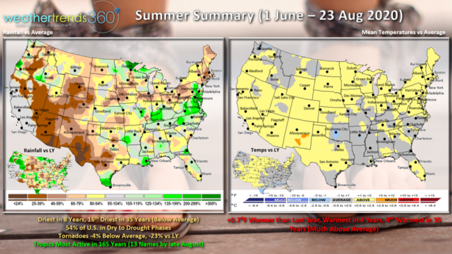
Summer according to meteorologists is 1 June - 31 August, so it's almost in the history books. With only a week left the Summer is trending warmest in 4 years, +0.7F warmer than last year and 4th warmest of the past 35 years. The Southeast U.S. has been similar to a tad cooler than last year while the Southwest to Upper Midwest has been warmer. Rainfall is the least in 8 years nationally and 16th driest of the past 35 years with below average national rainfall. 54% of the U.S. is currently in dry to drought phases and that's way up over last year. Tornadoes are fortunately trending 4% below average and 23% less than last year. Not so lucky in the tropics with the fastest start on record, 165+ years with 13 named systems already.
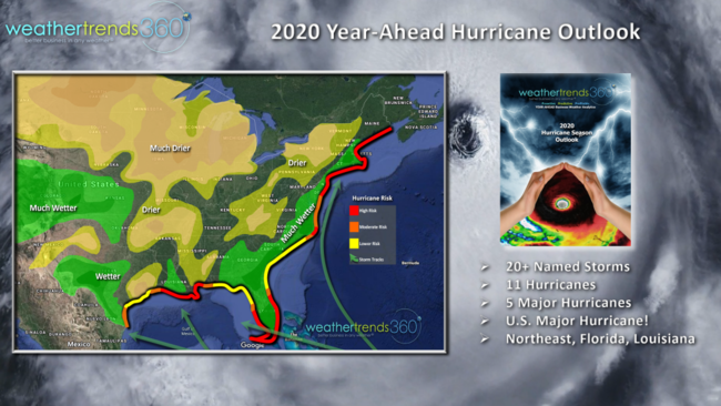
We are still very concerned about a $100+ billion dollar in damages from a major U.S. land-falling hurricane during the peak season of September-October, especially South Florida and New England! This will certainly be the most active season in 15 years as WTI warned a year ago.
This week we have two threats to the Louisiana area with T.S. Marco and soon to be Hurricane Laura.
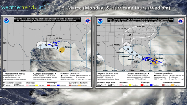
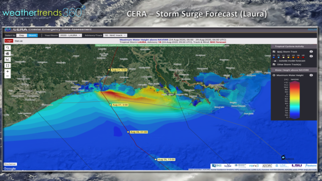
Laura is the more concerning storm for Wednesday in Western Louisiana. Fortunately that would be a less populate area but still upwards of a 10 foot storm surge with large waves on top of that along with 5"+ rainfall and some tornadoes.
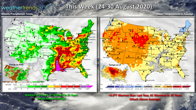
This week (24-30 August) looks to trend +4.0F warmer than last year making this the hottest end to August in over 35 years for the nation as a whole. Rainfall expected to be wettest in 3 years and 3rd wettest in 35 years with the land falling tropical systems bringing heavy rainfall to the South Central U.S.
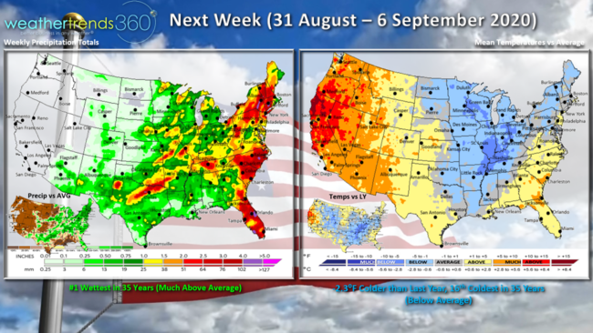
Next week (31 August - 6 September) a cold front will likely usher in some colder weather for the Midwest and Northeast with the nation trending 2.3F cooler than last year and 16th coolest in 35 years with below average national temperatures. The west remains the very hot spot with active wild fires likely to continue. Rainfall #1 wettest in 35 years, especially along the East Coast.
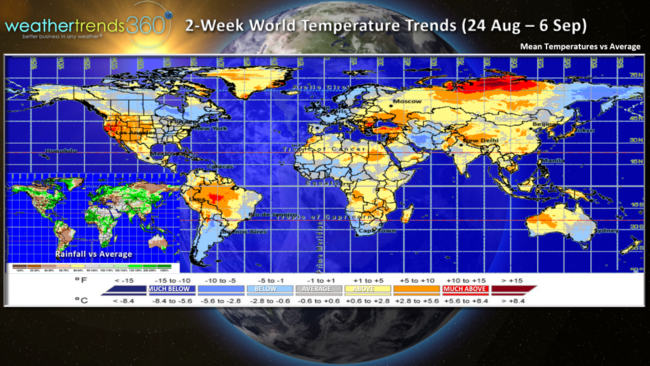
For the world overall, the next two weeks show cooler conditions in Canada and Central Europe, Argentina, The Middle East and Eastern Australia. The rest of the world on the warm side.
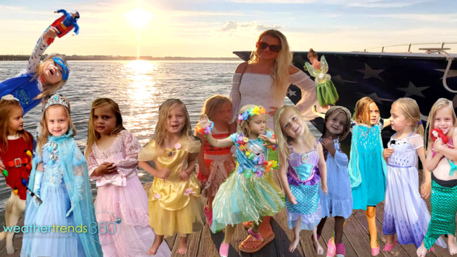
As the Q2 earnings reports show, home center sales and anything related to home merchandise are off the charts as many of us worked on our homes adding playgrounds, pools, etc. with the COVID challenges. We think Disney princess costume sales are up too since our little one - Angelina Kirk - has been every princess imaginable this Summer! :) The good news, if you like an extended Summer of warmer weather, this is your year with very likely warm conditions all the way into November!
We hope you have a great week and don't forget to follow us on social media: Facebook, Twitter, YouTube, Pinterest and Linkedin
- Captain Kirk out