Halfway Point of Meteorological Winter - U.S. Summary (1 Dec - 15 Jan)
Breaking Weather Events
We're half way through the meteorological Winter (1 Dec - 29 Feb) and so far it's a tale of two halves of the country - warm/little snow East, cold/snowy West.
National temperatures season-t0-date
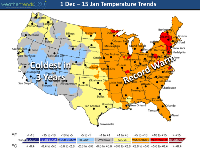
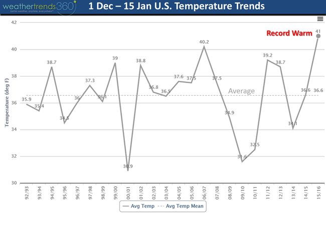
For a representative sample of 260 major cities across the U.S. we're trending the warmest Winter on record.
National precipitation season-to-date
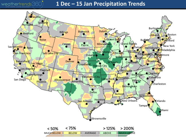
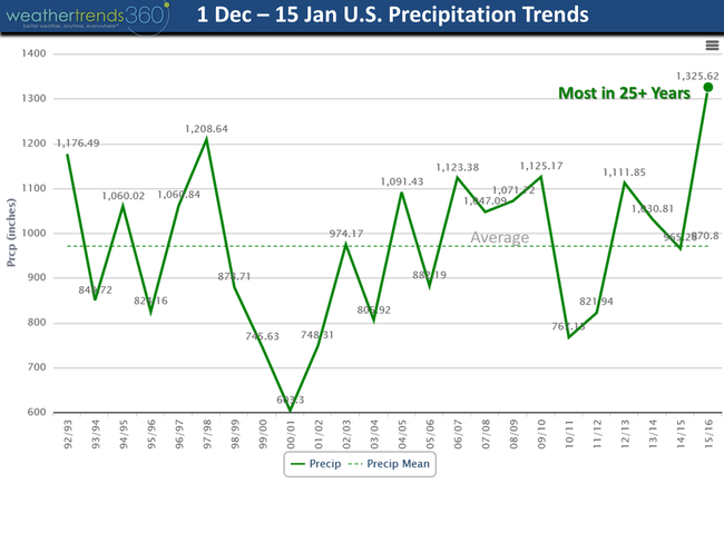
National U.S. precipitation trends over the past 25 years - record wet due in large part to the Central U.S.
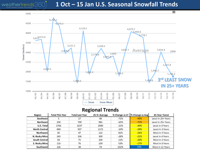
The snowfall index for 260 major cities across the U.S. shows the least snowfall in 4 years and 3rd least in 25+ years.
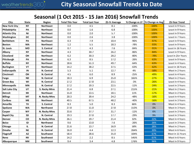
A sampling of cities and snowfall to date vs last year and vs average. Most in the East much below average while the Southwest locations are the snowy spots along with a few locations in the Central U.S. like Chicago.
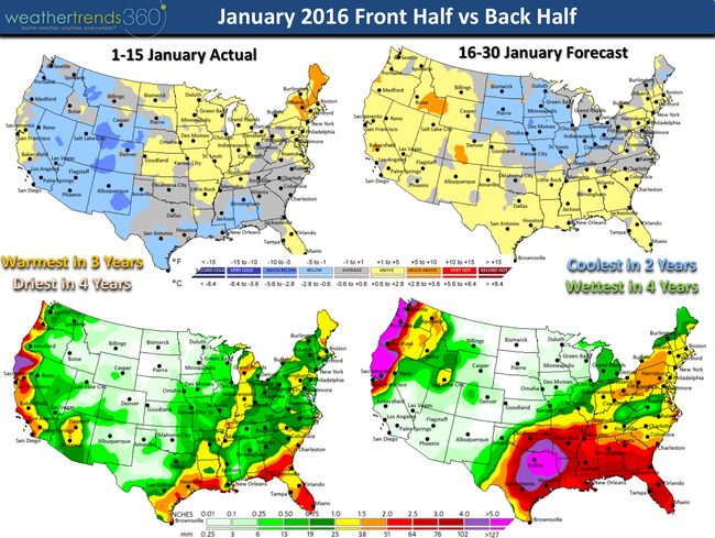
The front half of January was the warmest in 3 years and driest in 4 years. The back half looks to be the coolest in 2 years and wettest in 4 years but no major polar vortex's...yes the North Central U.S. is colder than average, but again, nothing way out of the ordinary.

National temperatures season-t0-date

For a representative sample of 260 major cities across the U.S. we're trending the warmest Winter on record.

National precipitation season-to-date

National U.S. precipitation trends over the past 25 years - record wet due in large part to the Central U.S.

The snowfall index for 260 major cities across the U.S. shows the least snowfall in 4 years and 3rd least in 25+ years.

A sampling of cities and snowfall to date vs last year and vs average. Most in the East much below average while the Southwest locations are the snowy spots along with a few locations in the Central U.S. like Chicago.

The front half of January was the warmest in 3 years and driest in 4 years. The back half looks to be the coolest in 2 years and wettest in 4 years but no major polar vortex's...yes the North Central U.S. is colder than average, but again, nothing way out of the ordinary.
