Capt's Log 2 March: 3rd Warmest Start to March in 35 Years!
Captain's Log
Welcome to meteorological Spring! :)
Meteorological Spring is defined as 1 March - 31 May and it looks to get off to the 3rd warmest start in over 35 years for the U.S. overall! Weather Trends had this very warm March outlook on the home page of our web site since last Summer...it's happening! :) CLICK ON IMAGES FOR A LARGER VIEW
And according to the sun...the Spring Equinox will be the earliest in 124 years on 19 March at 11:50pm EDT so good news if you like early Springs.
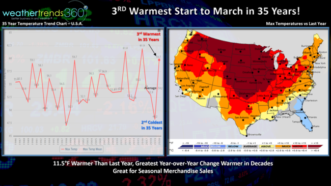
There is a huge benefit to spring seasonal merchandise sales with early warm March weather and these first 15 days of March trend a whopping 11.5F warmer than last year which was the 2nd coldest in over 35 years. This is one of the greatest YOY changes toward warmer weather in 124 years.
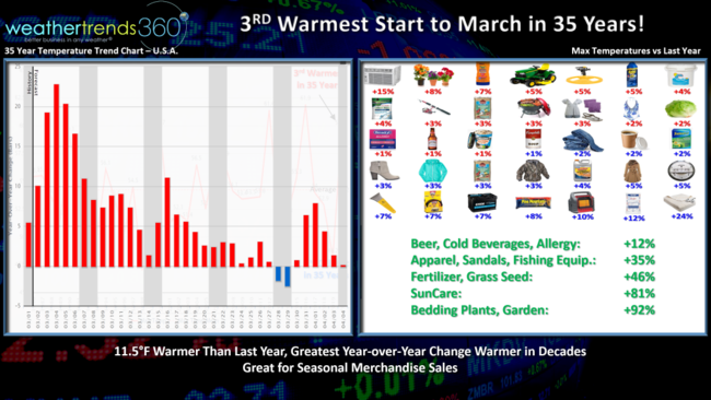
The benefit to seasonal merchandise will be strong double digit sales gains for many early spring categories. The good news trends continue for much of the month (see chart upper left which shows the expected year-over-year changes in national temperatures for the next 35 days).
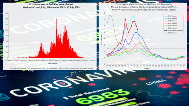
The unfortunate negative is the Coronavirus "black swan" that has many in panic. The virus is already diminishing in warmer climates, China so hopefully this virus behaves like SARS and plummets in activity as the weather warms up. SARS in theory is of the same family as the Coronavirus, so we'll see if it follows similar trends this Spring (chart left shows how SARS started off similar to Coronavirus in 2003 and ultimately diminished rapidly with warm Spring weather). Flu is already starting its Spring plunge in activity after a double peak of Type B flu in December and Type A in late Winter. These viruses typically survive on cold surfaces much longer (days) than they do on warm surfaces (minutes) so the odds of touching the virus (cold door handle, cold gas station pump, etc.) and then your eyes, nose, throat in part explains why they peak in Winter months around the world.
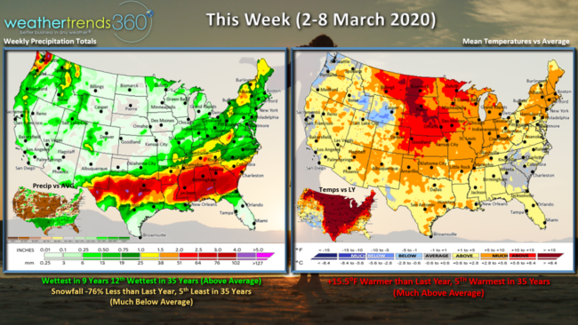 This week (2-8 March) shows the greatest YOY change toward much warmer weather in nearly 124 years. 15.5F warmer than last year and 5th warmest in 35 years for the U.S. overall. Rainfall is the wettest in 9 years, mainly across the Southern tier of the U.S. while snowfall is down 76% vs last year and 5th least in 35 years.
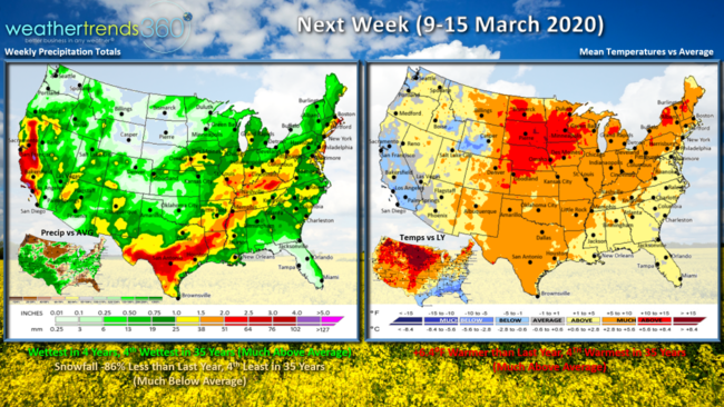
Next week (9-15 March) more of the same with the nation trending +6.4F warmer than last year and 4th warmest in 35 years. Rainfall still moderately high across the South and West with the wettest conditions in 4 years but snow is likely down 86%, 4th least in 35 years.
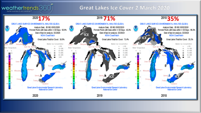
With the very mild Winter, the Great Lakes ice cover is well below average with only 17% of the lakes covered in ice vs 71% last year. This is one of many statistics that bodes well for a very warm Spring across the Eastern half of the country. The sun will spend less time melting ice and snow thereby warming up the land more quickly.
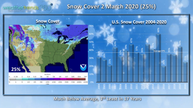
Snow cover across the U.S. stands at 25% which is well below the average of 37% and 3rd least in 17 years.
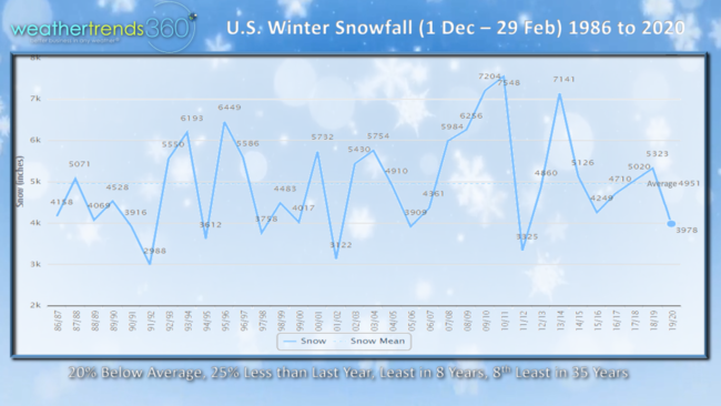
The winter snowfall (Dec - Feb) ended up 25% less than last year, 20% below average and 8th least in 35 years for the U.S. overall. WTI's year-ahead outlook suggested snowfall would be down 24% nationally so this wasn't a big surprise.
Don't forget to follow us on social media for more frequent updates. Facebook, Twitter, YouTube, Pinterest and Linkedin
Have a great week!