Captain's Log 9 Mar '20 Very Warm & Stormy!
Captain's Log
Happy Monday and welcome to Daylight Savings Time! :)
Every year more and more devices learn to change the time automatically, but of course those older devices like microwaves and some cars haven't figured it out yet. But another sign that SPRING IS HERE! CLICK ON IMAGES FOR A LARGER VIEW.

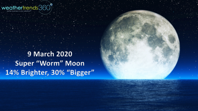
Another sign of Spring is the Super Worm Moon tonight that will appear 14% brighter and appear 30% bigger. It's the 2nd "biggest" aka closest moon of the year with the October 2020 moon being the smallest.
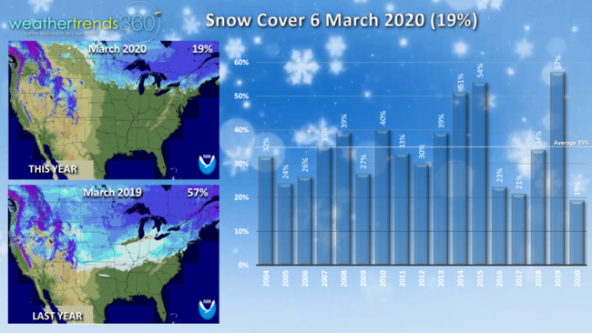
Snow Cover across the country shows the impact of the very warm start to Spring this year vs the very cold snowy start last year. Last year 57% of the U.S. still had snow on the ground, a near record high while this year is near record low at 19%. We'll take it! Average is around 35% for this time of year, mainly in the high elevations of the West and New England.
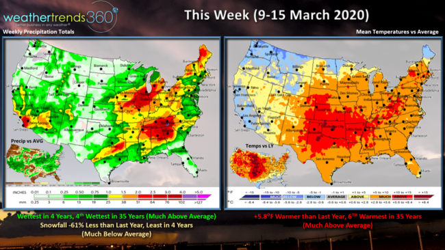
This week (9-15 March) shows a very warm pattern with the U.S. trending 5.8F warmer than last year and 6th warmest in 35 years. Rainfall wettest in 4 years and 4th wettest in 35 years with a stormy pattern, but snowfall down a whopping 61% vs a year ago and least in 4 years.
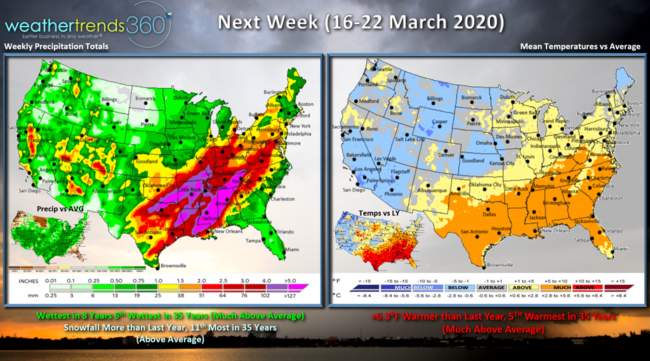
Next week (16-22 March) shows a continued warmer trend in the Eastern half of the U.S. with +6.3F warmer conditions than last year and 5th warmest in 35 years for the U.S. overall. Colder weather advancing in the West and Central U.S. could bring another round of severe weather and tornadoes from Texas to the Tennessee Valley. Also some risk for an early Spring snow event from the Central Plains into the Upper Midwest - TBD! U.S. overall looks to trend wettest in 8 years and 6th wettest in 35 years with snowfall up over last year and above average depending on the Central U.S. event.
Very clear we're headed for a La Nina pattern shift here in 2020 with rapidly cooling waters in the Equatorial Pacific.
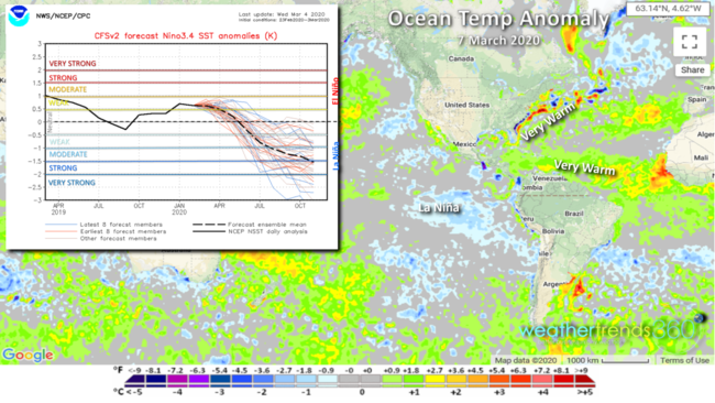
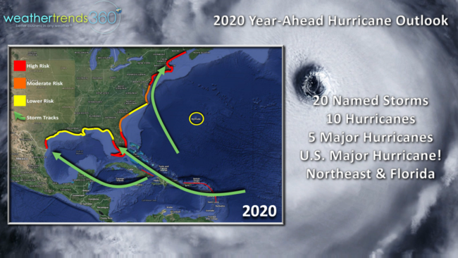
This combined with the very warm Atlantic Ocean and Gulf Stream among many other cycles and statistics suggest a high risk hurricane season ahead! We're very concerned about New England and Florida as the highest risk areas for land falling hurricane events.
We end today's video with a couple client testimonials.
Don't forget to follow us on social media with frequent updates. Facebook, Twitter, YouTube, Pinterest and Linkedin
- Captain Kirk out (USAF Gulf War Veteran 1989-1999)