Captain's Log 30 Jan '22 Big Pattern Shift
Captain's Log
Happy Sunday! :)
A recap of January here in the U.S. shows a cold month with the U.S. overall trending the coldest in 8 years, 12th coldest of the past 37 years with below average national temperatures particularly in the Upper Midwest and Northeast. CLICK ON IMAGES FOR A LARGER VIEW.
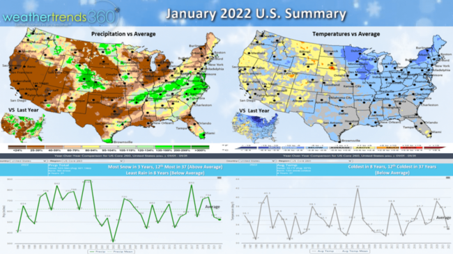
Rainfall was the least in 8 years as well and below average nationally, while Snowfall was the most in 3 years, 12t most in 37 years and well above average. The West went from near record wet and snowy in December to exceptionally dry in January.
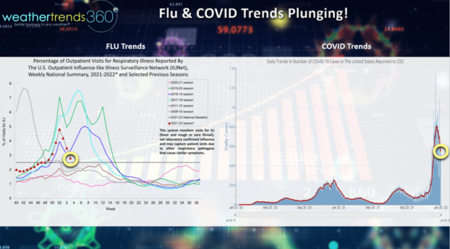
The other things trending down are Flu & Covid according to the CDC, let's hope these continue for the balance of Winter.
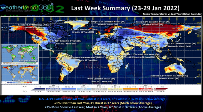
The World recap for last week (23-29 January) show the U.S. trending -4.3F colder than last year, coldest in 3 years and 6th coldest of the past 37 years. Rainfall was 76% less than last year and #1 driest in over 37 years while Snowfall was actually up +7% vs last year, most in 7 years and 6th most of the past 37 years - a snowy week! These were very strong trends for Winter seasonal merchandise sales for items like auto batteries, snow accessories, heavy weight winter apparel, etc.
Canada, the U.K., Russia all trended warmer while Europe - especially Southern/Eastern Europe and the Mediterranean areas, China, Australia, India all trended colder.
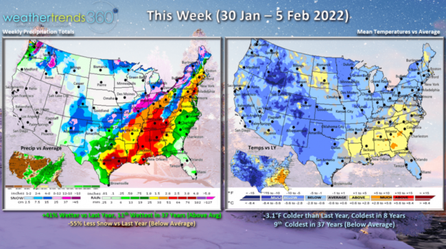
This week (30 Jan - 5 Feb) shows another colder week with the U.S. trending -3.1F colder than last year, coldest in 8 years and 9th coldest in 37 years for the U.S. overall. The big Nor'easter coastal storm that brought 1-3 feet of snow from Coastal Maryland to Maine is now exiting the East Coast. The big change is the colder weather in the West. Rainfall up +41% vs last year, 11th wettest in 37 years with a big rain and snow storm midweek in the Central U.S. While snowfall is down from a year ago, it will still be well above average with a bigger snow storm from Kansas to Michigan mid to late week with widespread 8-12" of snow.
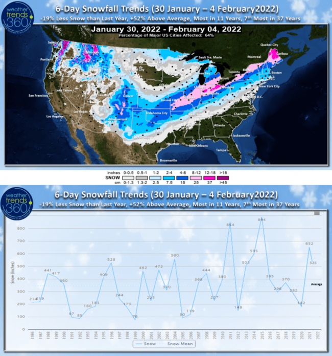
The 6-day snowfall trends shows this next storm will be well inland of the areas that got hit hard with the big coastal Nor'easter this past weekend.
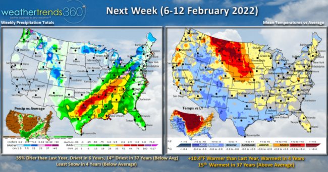
Next week (6-12 February) shows NO POLAR VORTEX THIS YEAR with the U.S. trending +10.4F warmer than a year ago, warmest in 4 years and 15th warmest in 37 years with above average national temperatures. Areas in the Central U.S. hit hard by last year's Polar Vortex are much warmer this year. Rainfall is trending down 35% and least in 6 years, 14th least in 37 years while snowfall is also likely to trend the least in 4 years. A February thaw! Don't get used to it as the cycles suggest a colder late February and March with a return to cold and snow for many.
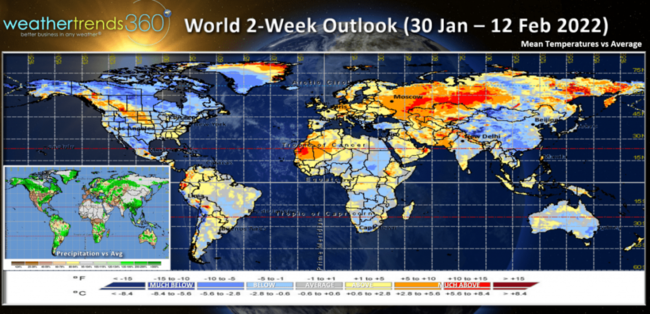
The 2-week World outlook shows the colder conditions in North America, Greenland, China and Australia with most of the rest of the World on the milder side.
Have a great week and don't forget to follow us on social media for frequent updates: Facebook, Twitter, YouTube, Pinterest and Linkedin.
- Captain Kirk out.