Captain's Log 28 Nov '21 Big Warm Up Coming
Captain's Log
Happy Sunday! :)
The World recap for last week (21-27 Nov) shows the U.S. trending 3.5F colder than last year, coldest in 3 years and 17th coldest of the past 36 years with below average national temperatures. CLICK ON IMAGES FOR A LARGER VIEW.
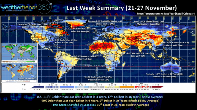
These were very favorable trends for cold seasonal merchandise sales and overall store traffic for the start of the holiday shopping season. Rainfall was 60% less than last year, driest in 4 years and 5th driest of the past 36 years (much below average). Snowfall was up +19% vs a year ago but still 10th least in 36 years and below average nationally.
Canada, U.K., Europe, Russia were all cooler than last year so favorable for cold seasonal merchandise, especially in the U.K. where it was the coldest in 5 years. Very cold for Spring down under in Australia, coldest in 22 years.
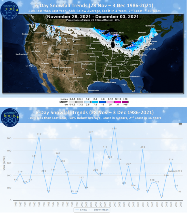
We had our first accumulating snow event here in Bethlehem, PA this morning, but for the U.S. overall the next 6-days still trend 10% less snow than last year, 58% less than last year, least in 4 years and 8th least in 36 years. Snowy spot is downwind of the Great Lakes.
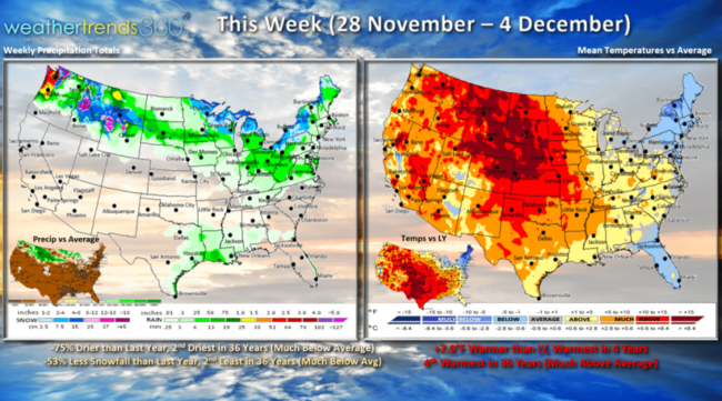
This week (28 Nov - 4 Dec): The big pattern change shows a nationwide warm up as the colder weather moves out of the Northeast. For the U.S. overall the week trends a whopping +7F warmer than last year, warmest in 4 years and 4th warmest of the past 36 years. Cold snowy start in the Northeast will give way to milder weather for the weekend ahead. Near record warmth in the Plains. Rainfall down 75% vs last year and 2nd driest in 36 years with snowfall also down 53% and 2nd least in 36 years nationally. So, a mild dry week is great for store traffic and holiday gift shopping, a negative for cold seasonal categories.
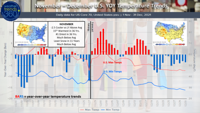
With November almost in the history books, the month was an overall plus for seasonal merchandise sales with the U.S. trending 2.5F colder than last year but still 15th warmest of the past 36 years. The East had below average temperatures, while the West was much above. Rainfall was the least in over 36 years and snowfall the least in 11 years. So the East was clearly the most favorable spot for cold seasonal merchandise sales. December looks to start off much warmer but very cold weather in Alaska and Northwest Canada looks to head south for the latter half of the month.
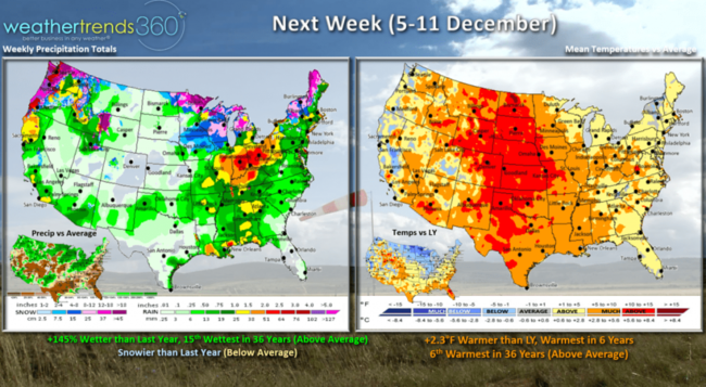
Next week (5-11 Dec) shows coast-to-coast above average temperatures trending 2.3F warmer than last year, warmest in 6 years and 6th warmest of the past 36 years. Rainfall up 145% over last year and 15th wettest with a stormier pattern for the West Coast and Ohio Valley. Snowier than last year but still below average with snowfall limited to the highest elevations of the Northwest and maybe the Great Lakes.
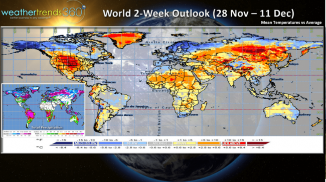
The 2-week world aggregate forecast shows the very cold air up in Alaska and NW Canada that originated out of Northeast Siberia. What goes up, usually comes down, so some of this colder weather likely to invade the lower 48 for the later half of December.
We hope you have a great week, and don't forget to follow us on social media for frequent updates: Facebook, Twitter, YouTube, Pinterest and Linkedin
- Captain Kirk out