Captain's Log 18 May '20 General Schwarzkopf, Queen and Weather!
Captain's Log
Good morning! :) Day 62 remote lock-down for us. :(
On this Monday 29 years ago, I was then 1LT Kirk stationed at MacDill AFB and remember the 3 am morning visit well. General "Stormin Norman" Schwarzkopf came in and said "good morning lieutenant, just looking for a weather update for the Queen's visit today." I explained there would be sea fog and sprinkles ending as she was arriving and then sunny skies as his Knighting ceremony started in our F-16 hangar. This was the 3rd but final time I would meet him on active duty. We'll let you watch the video beginning for "the rest of the story" on what happened this day 29 years ago. CLICK ON IMAGES FOR A LARGER VIEW
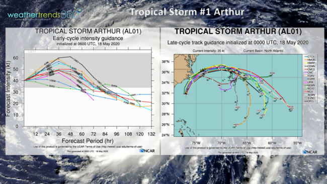
We're off to a fast start with the first Tropical Storm of the season (Arthur). It dropped 3-6" of much needed rain on South Florida before officially becoming a Tropical Storm off the East Coast of Florida. From here it will come close to the Outer banks of North Carolina but pretty much remain a fish storm, not making landfall. Still some moderately heavy rain for North Carolina.
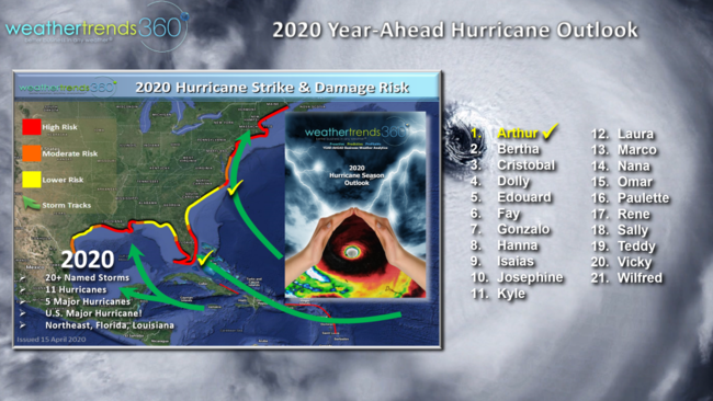
This is just the start of what we expect to be an extremely active and devastating season ahead with several high risk threat areas in South Florida, NYC Long Island and New Orleans. For smaller scale tornado events, we're starting to see the expected much less active May this year resulting in tornado activity down 7% vs last year, near average but way down from the devastating 2011 season when there were 1,328 tornadoes at this point in the season. We expect these trends to continue to be much lower than last year and below average through early Summer.
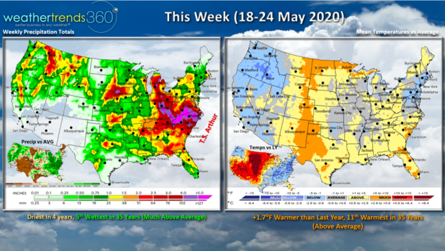
This week (18-24 May) starts off cool in the East with Easter flow off the Atlantic as Arthur meanders up the coast and then out to sea. The week trends +1.7F warmer than last year, 11th warmest in 35 years for the U.S. overall, above average. The cool trends in the Northeast will give way to a much warmer Memorial Day weekend. Rainfall is the least in 4 years but still very wet trending 5th wettest in 35 years due in large part to an Easterly flow off the Atlantic Ocean to the North of Arthur.
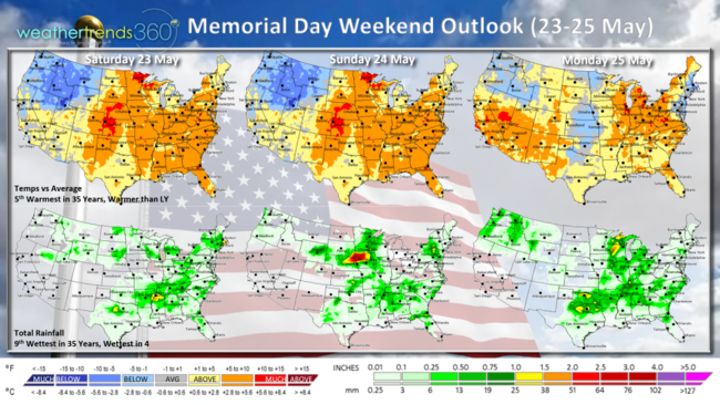
The Memorial Day weekend turns much warmer in the East while the Pacific Northwest remains the cool spot. Overall the holiday weekend trends 5th warmest of the past 35 years and 9th wettest.
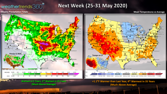
Next week (25-31 May) the last week of May looks to trend 1.1F warmer than last year and 4th warmest in 35 years...a positive trend for seasonal merchandise sales for the unofficial kick-off to Summer. On the stormy side trending wettest in 5 years and 3rd wettest in 35 years for the nation as a whole.
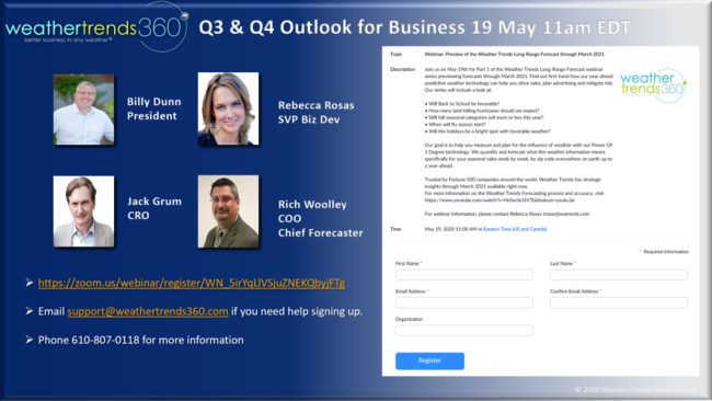
If you're in the retail, seasonal supply, financial services or Pharma industries, please join us tomorrow, 19 May at 11am EDT for our Fall - Winter outlook and what it means for Q3 and Q4 sales. The team will discuss just about everything from a bad Allergy Fall season (much warmer/drier), destructive hurricanes in early Fall, good Back2School, good Christmas holiday season but a much needed 5-week delay to the Winter Flu season...and what it means for your business. SIGN UP
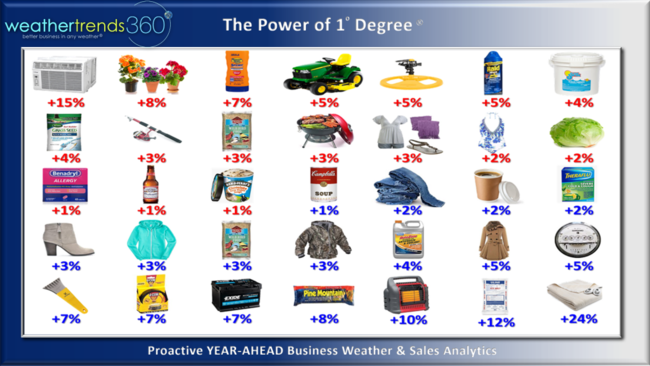
You'll get a bit more detail on our Power of 1 Degree technology and how it predicts your seasonal sales a year-ahead by zip code or every mile on Earth.
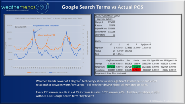
This example shows how on-line Google search terms frequently match your POS sales data at brick and mortar store locations. Look for more details on how this can be used to better predict on-line sales a year ahead everywhere on Earth!
Have a great week and don't forget to follow us on social media for frequent updates:Facebook, Twitter, YouTube, Pinterest and Linkedin
- Captain Kirk out...actually day 62 IN!