Captain's Log 15 Apr '23 Moderate to Strong El Nino Developing
Captain's Log
15 April '23: Happy Saturday! :)
NOAA has officially declared an El Niño watch, but there is near certainty we're headed for a moderate to strong El Niño pattern this Summer after 3 years under La Niña. CLICK ON IMAGES FOR A LARGER VIEW.
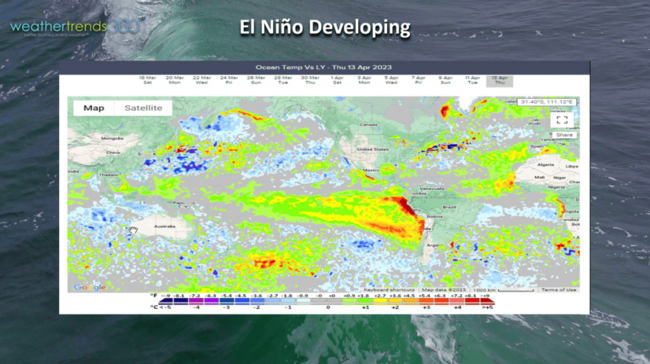
The Ocean temperatures vs this time last year show much warmer waters off of South America in the Eastern Equatorial Pacific Ocean while there is a general cooling of the Indian Ocean.
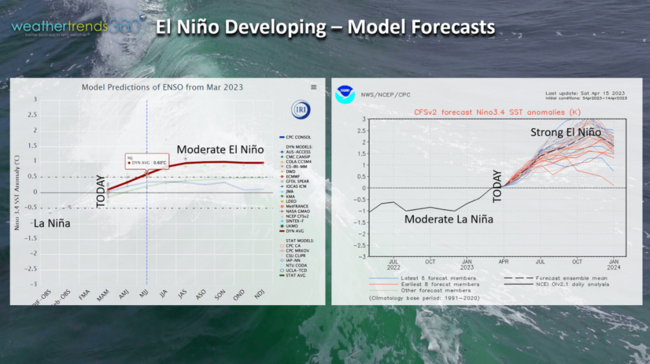
Government models show anywhere from a moderate to strong El Nino developing this year which will bring huge changes to the world weather patterns here in 2023 and 2024. The pattern is already showing the expected trends with a wetter stormier U.S. after several years of drier to drought conditions.
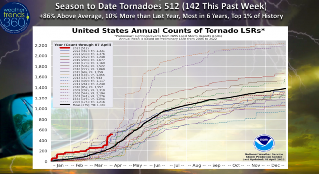
U.S. tornadic activity took a bit of break last week, but the U.S. still on a near record fast pace with 512 to date, +86% above average, +10% more than last year and the most in 6 years. The last seasons this active were in 2017 (542) and 2008 (618).
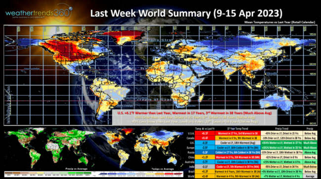
A recap of last week (9-15 April) around the World shows the U.S. trending +6.1F warmer than last year, warmest in 17 years, 3rd warmest in 38 years with much above average national temperatures. Rainfall was -43% drier than a year ago, driest in 15 years and 6th driest of the past 38 years with well below average rainfall. Snowfall was down -83% vs last year, the first week to trend below last year's level in nearly two months. All of these are extremely favorable trends for Spring retail seasonal sales and store traffic. Canada was also very favorable while the U.K. and Western Europe were much less favorable with cooler/wetter trends.
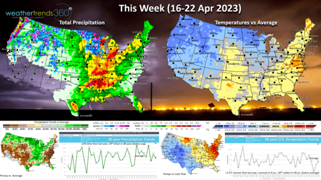
This week (16-22 April) shows another potentially dangerous set up with colder weather in the Plains clashing with warmer weather in the Southeast. This will likely lead to an uptick in severe thunderstorms and tornadoes from East Texas to the Ohio Valley. For the U.S. overall temperatures trend +1.5F warmer than last year, warmest in 4 years but 16th coolest in 38 years. The most favorable areas for stronger seasonal sales is the Northeast - Middle Atlantic where temperatures are still much warmer than a year ago and above average. Rainfall -13% less than a year ago and 14th driest of the past 38 years. These are generally favorable for seasonal category YOY sales but not as good as last week.
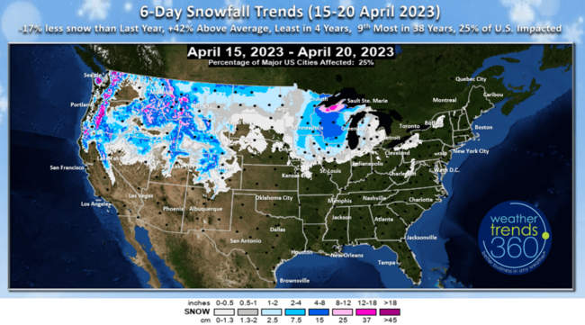
The 6-day snowfall outlook (15-20 April) shows another moderate snow event for the Rockies moving into the Upper Midwest. 25% of the U.S. impacted by snow, significant by April standards. Snowfall totals +42% above average nationally, but that is -17% less than last year.
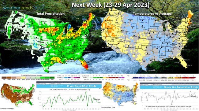
Next week (23-29 April) for the U.S. shows national temperatures trending +0.9F warmer than last year but still 17th coolest of the past 38 years with below average national temperatures, especially in the North Central U.S. and Tennessee Valley areas. Rainfall similar to last year and 12th driest of the past 22 years.
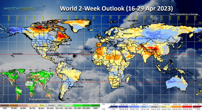
The 2-week World outlook (16-29 April) shows Western Europe and the U.K. becoming more favorable for seasonal category sales with softening in Canada and the U.S.
We hope you have a great week and don't forget to follow us on social media for frequent updates: Facebook, Twitter, YouTube, Pinterest and Linkedin.
- Captain Kirk out.