Captain's Log 13 Apr '20 Very Cold then Big Warm Up
Captain's Log
Happy Monday. :)
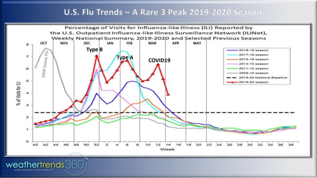
The Flu is starting its typical Spring plunge in activity and any luck COVID19 may have also peaked across Europe and U.S. East/West Coasts where it started sooner than the Midwest U.S. CLICK ON IMAGES FOR A LARGER VIEW.
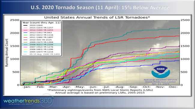
The other thing trending down is tornadoes across the U.S. which are 15% below average and 58% less than the extremely active year of 2008. Some severe weather over the Easter weekend in the Southeast, but we expect these lower trends to continue through the Spring season with a much less active May with warmer/drier conditions than last year.
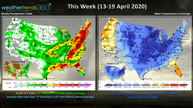
This week (13-19 April) COLD! The coldest in 35+ years for the U.S. overall with national temperatures 6.4F colder than a year ago, a big negative for seasonal merchandise sales that did well in middle April last year with warmer conditions. The exceptions are Florida and the West Coast. Rainfall is driest in 3 years nationally but that's still 15th wettest in 35 years (near average). The snow storm that moved through the Plains and Upper Midwest over the Easter weekend is exiting the Great Lakes and heading into Southeast Canada but that's made this week the 3rd snowiest in 35 years.
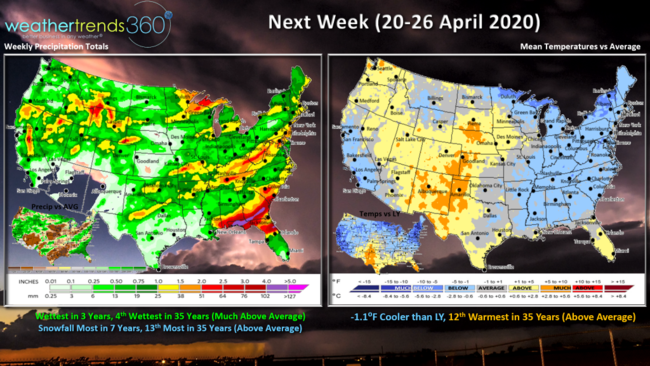
Next week (20-26 April) a moderating trend across the U.S. with the nation trending 12th warmest in 35 years with above average temperatures overall. Still cool in the East but a moderating trend of warmer weather through the week. Still on the wet and stormy side, but the Midwest Center of the Country is generally dry as farmers begin planting.
The world 2-week summary shows Western Europe generally warm/wet while Eastern Europe is cooler/drier. Warmer than average conditions across much of Russia, the Middle East into Southeast Asia.
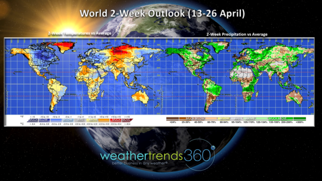
For a few months now we've had our high level November 2020 world outlook up on the home page of our web site, but the information we provide clients is substantially more detailed.
Many of our clients not only know how the weather will trend week-by-week a year-out, very mile on Earth, but also how that will specifically influence their sales a year-out, week-by-week, store-by-store.
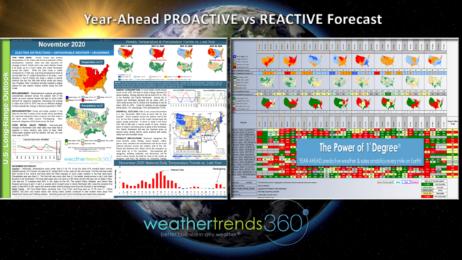
Clients that use our award winning Power of 1 Degree® technology can take the PROACTIVE forecast outputs and put them into their planning systems for a more accurate sales forecast for thousands of seasonal items. And we do that in 30 seconds per category. In addition to the forecasts, the Power of 1 Degree Rules of Thumb are a big heat as it simply explains the movement of sales vs small changes in weather. As an example, every 1F warmer in Spring there is a 3% increase in apparel sales, 10 degrees warmer 30% but there is a down side. Every 1F colder a 3% decline so this week trending 6.4F colder than last year suggest at least a 19% decline in sales, layer in other external factors and it's a bad week for seasonal items.
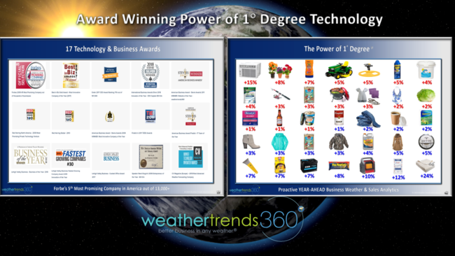
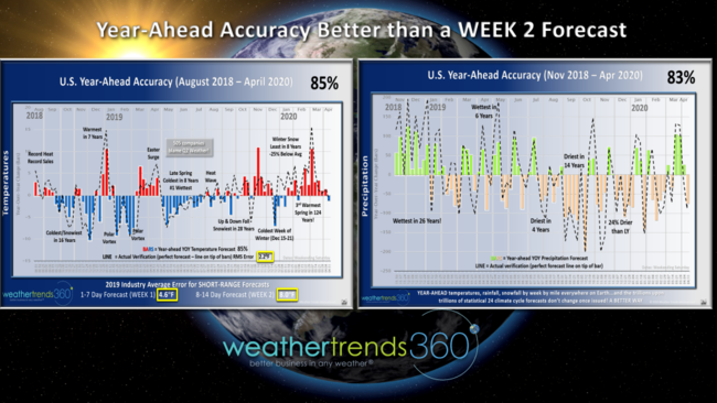
Our year-ahead weather forecast accuracy is more accurate than a week 2 short range forecast by several degrees, and it even out performs a week 1 short range forecast frequently. Trillions of statistics and 24 climate cycles (our approach) trump physics and short range modeling, a BETTER WAY to plan a YEAR-AHEAD.
We hope you had a great Easter weekend with HOPE on the horizon for a brighter day! The Mrs. Captain Kirk and little Angelina enjoyed the warming trend through the Easter weekend and we're thinking WARM SPRING WEATHER...had to tell the little one to take off her Elsa frozen dress as we had SNOW SHOWERS on Good Friday!

Have a great week and don't forget to follow us on social media for frequent updates: Facebook, Twitter, YouTube, Pinterest and Linkedin
- Captain Kirk out