Captain's Log 1 June - Spring World Recap, Tropical Threat and 2-week Outlook
Captain's Log
Hard to say GOOD morning with everything going on...but here's to a brighter day.
Spring 2020 is officially in the history books, at least meteorological Spring (1 March - 31 May) and it was on the warm side in the U.S. due in large part to a very warm March and warmer later half of May. For the U.S. overall, Spring was 1.3F warmer than last year making it the 13th warmest of the past 35 years with above average temperatures. Rainfall was bit drier than last year but still 9th wettest in 35 years for the U.S. overall. But the rainfall was feast or famine with some areas very dry others very wet. CLICK ON IMAGES FOR A LARGER VIEW.
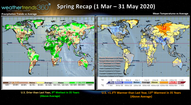
Russia had much above average temperatures trending warmest in over 35 years, Europe the warmest in 6 years, the U.K. warmest in 3 years. The cooler areas were India and Brazil coolest in 5 years, Canada the coolest in 6 years and Australia's Fall coolest in 8 years.
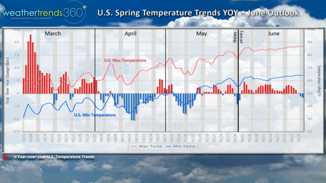
U.S. spring temperatures compared to last year show the much warmer start in March, then a cooler April followed by a warmer trend for the latter half of May. Overall the Spring was much more favorable for seasonal merchandise but obviously the virus had a huge impact on brick and mortar stores while retailers with strong e-commerce and a more diverse product offering fared much better. The big winners in retail were Wal-Mart, Amazon, Target, Costco, BJs, Wayfair, Home Depot and Lowes. Mall based stores and apparel retailers with limited offerings experienced 40% to 60% declines in sales with the store closures.
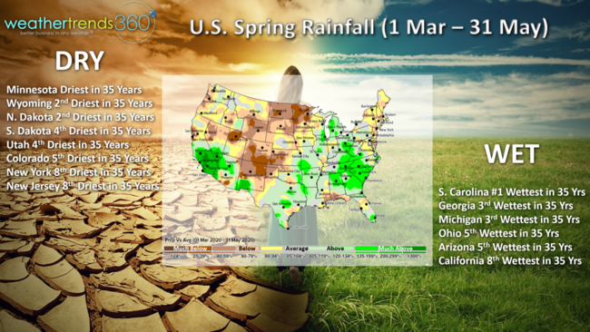
Rainfall showed stark differences over short distances with some very dry areas and others very wet. The dry areas were in the Northwest, Rocky Mountains into the Central Plains. The Northeast was also on the dry side despite a fair amount of gloomy, cloudy days. The really wet areas were in the Southeast and Southern California. Dry to drought-like conditions are going to expand this year and into 2021 with the driest conditions in 6 years as we transition into 2021
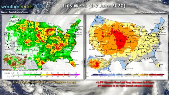
This week (1-7 June) is the start of meteorological Summer and it's on the warm side. For the U.S. overall the week trends 1.4F warmer than last year, warmest in 9 years and 2nd warmest in 35 years for the nation as a whole. Rainfall looks to trend less than last year and 9th driest in 35 years. Need to watch for severe weather activity in the Midwest this week. But tornadoes continue to trend below average for the season-to-date and down significantly vs last year.
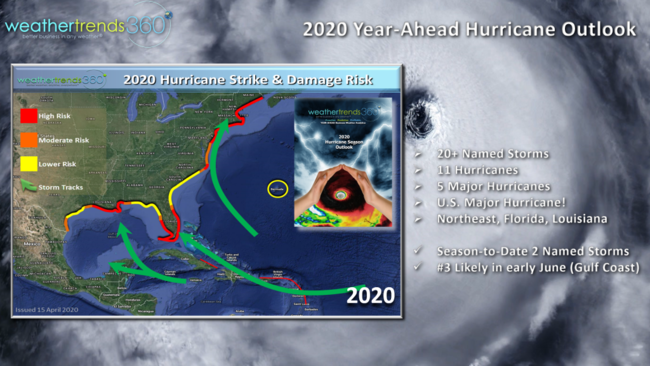
The first tropical system of the season in the Pacific Amanda will make an unusual move across Central America and could redevelop into the 3rd named system in the Gulf of Mexico later this week.
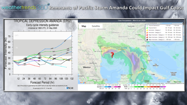
Anyone along the Gulf of Mexico should monitor this system as things can and will flare up very quickly this year with a very favorable cycle for significant land-falling threats in the U.S.
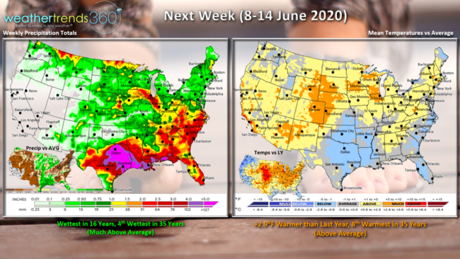
Next week (8-14 June) shows more of the same with the U.S. trending 2.9F warmer than a year ago and 8th warmest of the past 35 years. Rainfall up with the tropical threat trending wettest in 16 years and 4th wettest in 35 years assuming the system makes its way into the U.S.
For businesses interested in more of our year-ahead outlook, we have another webinar Tuesday 2 June 11am EDT. To register CLICK HERE.
Have a great week and don't forget to follow us on social media for frequent updates. Facebook, Twitter, YouTube, Pinterest and Linkedin
- Captain Kirk