August 2020 Weather Review
Captain's Log
Happy Monday! :)
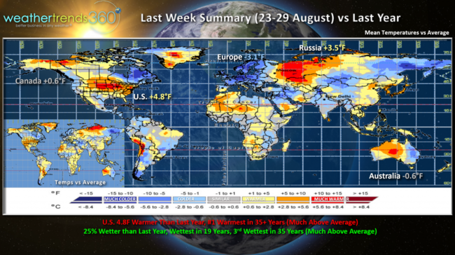
The last retail week of August (23-29 August) ended on a very hot note for the U.S. overall but cooler across Europe and Eastern Australia. CLICK ON IMAGES FOR A LARGER VIEW.
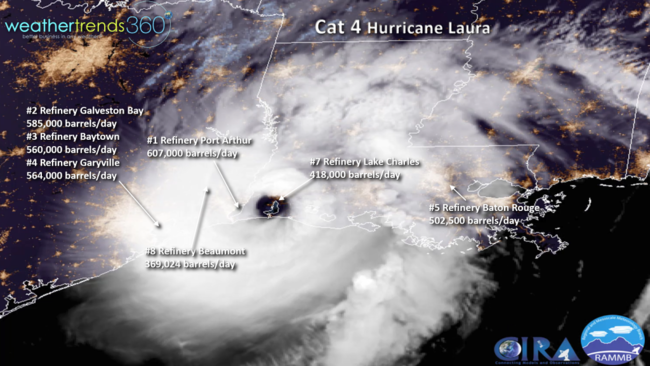
The big news last week was obviously Cat 4 Hurricane Laura, the 2nd strongest hurricane to hit Louisiana in 169 years of record. Early estimates suggest upwards of $8-$12 billion in damages. The eye went right over Lake Charles, LA which had the most damage including the #7 oil refinery (Citgo, Phillips66) in the U.S. that will likely be shut down for weeks. Refineries just to the West of the eyewall fared much better. Sadly at least 10 deaths attributed to the storm.
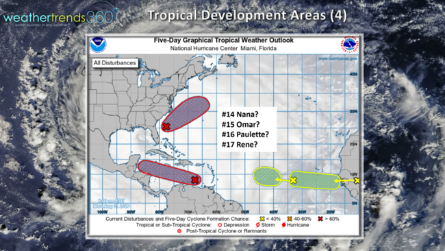
The tropics remain active with the National Hurricane Center watching 4 potential systems, none look to impact the U.S. this week.
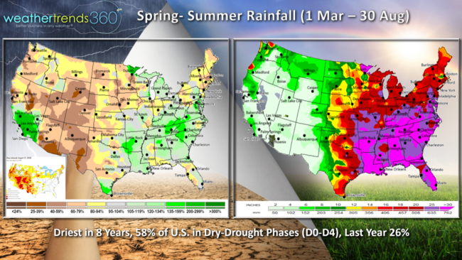
Spring-Summer rainfall has been feast for famine across the U.S., but overall the country is trending the driest in 8 years with 58% of the country now in dry to drought-like phases.
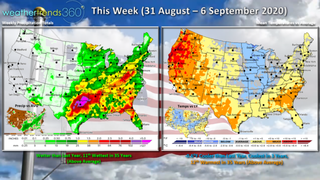
This week (31 Aug - 6 Sep) shows the first significant cool down for the Central U.S. and gradually spreading East. For the U.S. overall, the week looks to trend the coolest in 3 years but still 12th warmest of the past 35 years with the extreme heat in the Western U.S. Rainfall is wetter than last year, 11th wettest in 35 years with much needed rainfall possible in the South Central U.S.
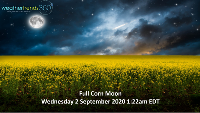
It's the Full Corn Moon on Wednesday for those of you who like all things in the night sky.
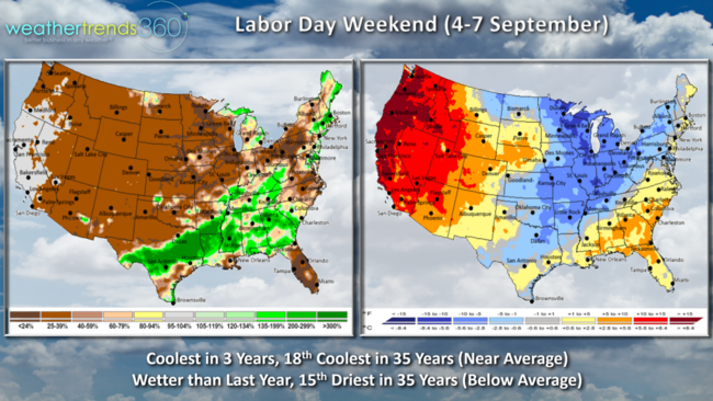
Labor Day weekend (4-7 Sep) shows the expanding cooler than average temperatures in the Midwest, Great Lakes and Northeast, while the West continues to bake. Overall it's the coolest Labor Day weekend in 3 years, 18th coldest in 35 years with near average national temperatures when factoring in the two extremes. A bit wetter than last year but still 15th driest of the past 35 years with below average national rainfall. This is the first good taste of Fall, so it will help some Back2School categories with a cooler September than a year ago.
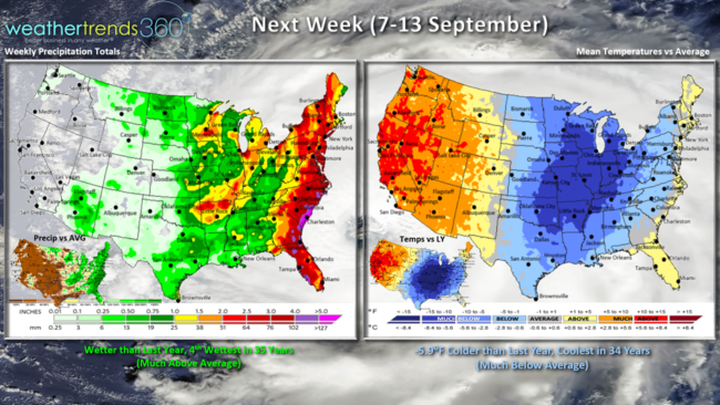
Next week (7-13 Sep) expanding cool conditions in the Eastern half of the country. For the U.S. overall the week looks to trend 5.9F cooler than last year and potentially the coolest in 34 years with much below average national temperatures. Rainfall is heaviest along the East Coast, making the national trend the 4th wettest in 35 years. Hopefully some much needed rain in Arizona.
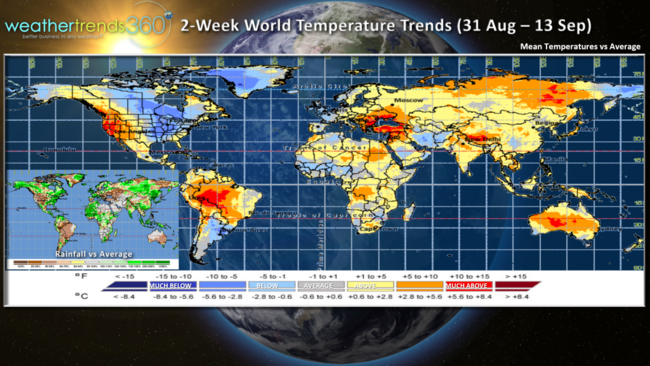
For the World as a whole, the 2-week period (31 Aug - 13 Sep) shows the cooler trends across Eastern North America, Greenland, Argentina and extreme NE Siberia while the rest of the world is generally warmer than average.
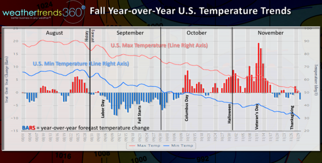
The U.S. Fall outlook compared to a year ago shows the cooler start here in September but followed by a much warmer and much less snowy October - November. So, some good news for early Fall and Back2School merchandise, but expect a major slow down the rest of the year with much warmer conditions.
Have a great week, and don't forget to follow us on social media for frequent updates: Facebook, Twitter, YouTube, Pinterest and Linkedin
- Captain Kirk out.