2nd Nor'easter of 2018 Brings More Snow
Breaking Weather Events
Everything is coming together for our next Nor'easter. There's little change from yesterday's forecast other than growing confidence in an impactful event from northern Maryland to northern New England.
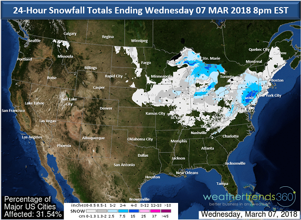
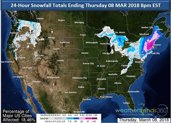
The heaviest snow is set to fall near or just west of the I-95 corridor from near Philadelphia and northward. Some areas will see over a foot of snow and widespread 6-12'' of snow is expected form eastern Pennsylvania up to Maine.
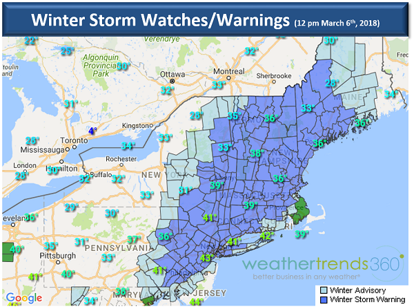
Winter Storm Warnings have been issued by the National Weather Service, covering an area from eastern Pennsylvania, northern New Jersey, and up through Maine. The map below shows the Winter Storm Watches (light blue) and Warnings (dark blue) as of 12 pm Tuesday, March 6th. A reminder that warnings mean a storm is imminent, while a watch means there's a potential. Basically, a warning means there's higher confidence of a significant event than a watch.
A rain/snow mix starts tonight in the Mid-Atlantic and switches to all snow overnight. Very heavy snow is possible during the day tomorrow with +1'' per hour rates making travel difficult. If you can, stay home. The snow wraps up Wednesday evening in the Mid-Atlantic but lingers in northern New England into Thursday morning.
Winds will be strongest closer to the coast sustained at 20-30 mph with gusts over 50 mph. We want to emphasis that many trees have been weakened with the last storm and with the addition of heavy, wet snow on top, we're likely to see more power outages. So while the winds may not be as strong as last week's storm, the potential for power outages will be very real.
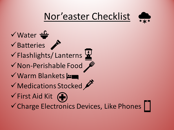
Today is a good time to make sure you're prepared. Check to make sure the snow blower is in working order. If you have any large limbs or compromised trees dangling precariously close to your home, you may want to take care of those if you can. Grocery stores will likely see a run on bread, milk, and eggs as consumers prepare for mass French toast baking, but more importantly, you should check to make sure you have batteries, flashlights, and bottled water if you end up without power.
Once we clear this storm, the attention will turn to the threat of another storm early next week.
The heaviest snow is set to fall near or just west of the I-95 corridor from near Philadelphia and northward. Some areas will see over a foot of snow and widespread 6-12'' of snow is expected form eastern Pennsylvania up to Maine.


Winter Storm Warnings have been issued by the National Weather Service, covering an area from eastern Pennsylvania, northern New Jersey, and up through Maine. The map below shows the Winter Storm Watches (light blue) and Warnings (dark blue) as of 12 pm Tuesday, March 6th. A reminder that warnings mean a storm is imminent, while a watch means there's a potential. Basically, a warning means there's higher confidence of a significant event than a watch.

A rain/snow mix starts tonight in the Mid-Atlantic and switches to all snow overnight. Very heavy snow is possible during the day tomorrow with +1'' per hour rates making travel difficult. If you can, stay home. The snow wraps up Wednesday evening in the Mid-Atlantic but lingers in northern New England into Thursday morning.
Winds will be strongest closer to the coast sustained at 20-30 mph with gusts over 50 mph. We want to emphasis that many trees have been weakened with the last storm and with the addition of heavy, wet snow on top, we're likely to see more power outages. So while the winds may not be as strong as last week's storm, the potential for power outages will be very real.
Today is a good time to make sure you're prepared. Check to make sure the snow blower is in working order. If you have any large limbs or compromised trees dangling precariously close to your home, you may want to take care of those if you can. Grocery stores will likely see a run on bread, milk, and eggs as consumers prepare for mass French toast baking, but more importantly, you should check to make sure you have batteries, flashlights, and bottled water if you end up without power.

Once we clear this storm, the attention will turn to the threat of another storm early next week.